Wild About Lochaber

Wild About Lochaber

where great adventures begin...

Search form

Menu

  • Home
  • Explore
    • Wild Lochaber
    • Ardnamurchan, Moidart & Morvern
    • Fort William and Glen Nevis
    • Glencoe and Loch Leven
    • The Road To The Isles
    • #WildLochaber Photo Gallery
  • Accommodation
    • Hotels and B&Bs
    • Caravan & Campsites
  • Walking
    • Map of All Walks
    • Ardnamurchan and Moidart
    • Arisaig Mallaig and Glenfinnan
    • Fort William and Glen Nevis
    • Glencoe, Loch Leven & Argyll
  • Wildlife
    • Map of Wildlife Sites
    • Wildlife Experiences
    • Wildlife Habitats
  • Things To Do
    • Activity Providers
    • Beaches
    • Castles
    • Destinations
    • Gardens
    • Geology
    • Geopark Rock Route
    • Historic Attractions
    • Museums and Interpretation
    • Railways
    • Wildlife Experiences
    • Wildlife Hotspots
  • Travel
    • Electric Vehicle Charging Points
    • Ferries
    • Petrol Stations
    • The Caledonian Sleeper
  • What's On
    • Calendar
    • Arts, Culture and Community Events
    • Family Friendly Events
    • Walking Events
    • Wildlife & Geology Events
    • Events on Discover Glencoe
    • Road to The Isles & Ardnamurchan
  • Blogs
    • Ardnamurchan Area Blogs
    • Glencoe Area Blogs
    • Lochaber Blogs
    • West Coast Island Blogs
    • Wild About Lochaber Blog

Shielfoot Torr

  • The Torr at Shielfoot near Acharacle
  • Looking down The River Shiel from Shielfoot Torr
  • The start of the path to Shielfoot Torr, opposite Shielfoot Organics
  • The path to Shielfoot Torr
  • The path to Shielfoot Torr
  • Along the strean, through the gate and into the field between the two summits of Shielfoot Torr
  • The gateway to Shielfoot Torr
  • Through the field and onwards to explore Shielfoot Torr
  • Through the field and onwards to explore Shielfoot Torr
  • Through the field and onwards to explore Shielfoot Torr
  • Through the field and onwards to explore Shielfoot Torr
  • Shielfoot Torr, a community play ground
  • Follow the path north from the field up the west side of the hill
  • Follow the path north from the field up the west side of the hill
  • Looking over Kentra Bay from Shielfoot Torr
  • Looking over The River Shiel from Shielfoot Torr
  • Looking over The River Shiel from Shielfoot Torr
  • Looking over The River Shiel from Shielfoot Torr
  • Looking over The River Shiel from Shielfoot Torr
  • Looking over The River Shiel from Shielfoot Torr
  • Looking over The River Shiel from Shielfoot Torr
  • Looking over The River Shiel from Shielfoot Torr
  • Lungwort lichens on the ancient oak woodlands on Shielfoot Torr
  • Ancient Atlantic Oak woodlands on Shielfoot Torr
  • Ancient Atlantic Oak woodlands on Shielfoot Torr
  • Ancient Atlantic Oak woodlands on Shielfoot Torr
  • Ancient Atlantic Oak woodlands on Shielfoot Torr
  • Looking over Kentra Bay from Shielfoot Torr
  • Walking through the ancient Atlantic oak woodlands on Shielfoot Torr
  • Walking through the ancient Atlantic oak woodlands on Shielfoot Torr

Details

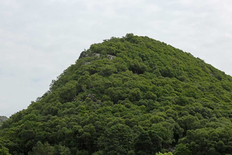
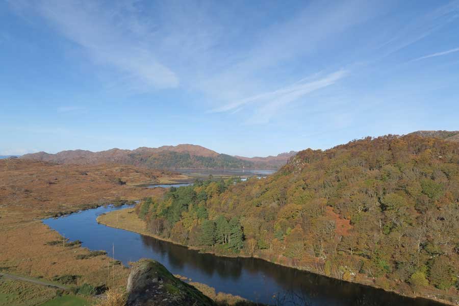
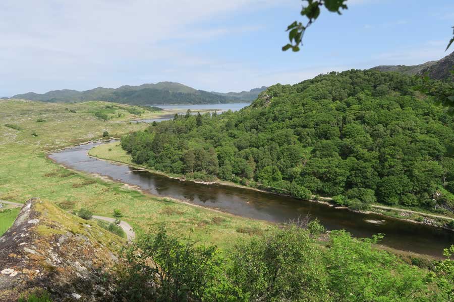
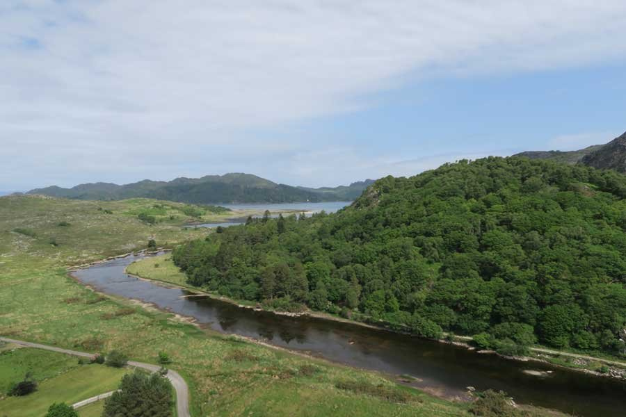
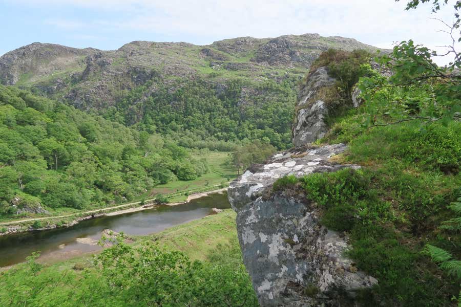
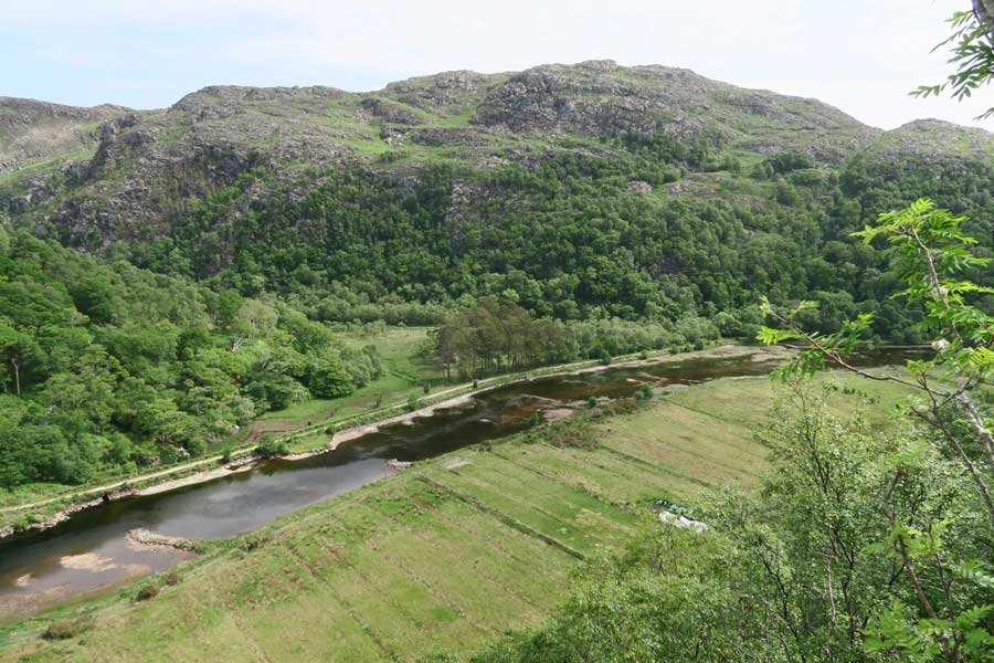
A stunning walk to the vitrified iron-aged fort at Shielfoot Torr. A secret journey through ancient oak woodlands to the knife edge ridge with stunning views over The River Shiel and beyond.

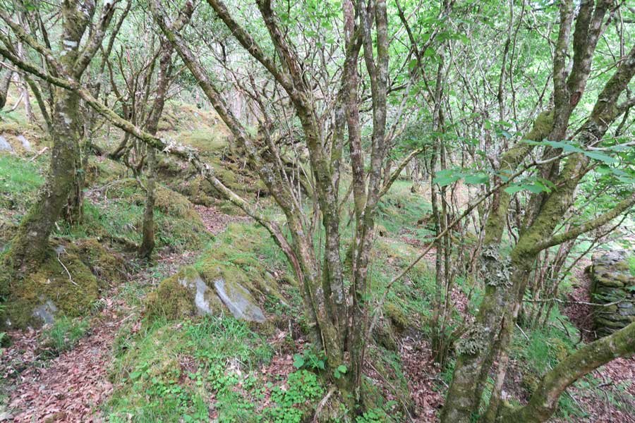
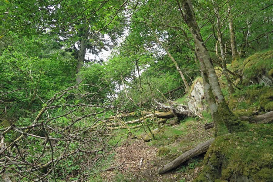
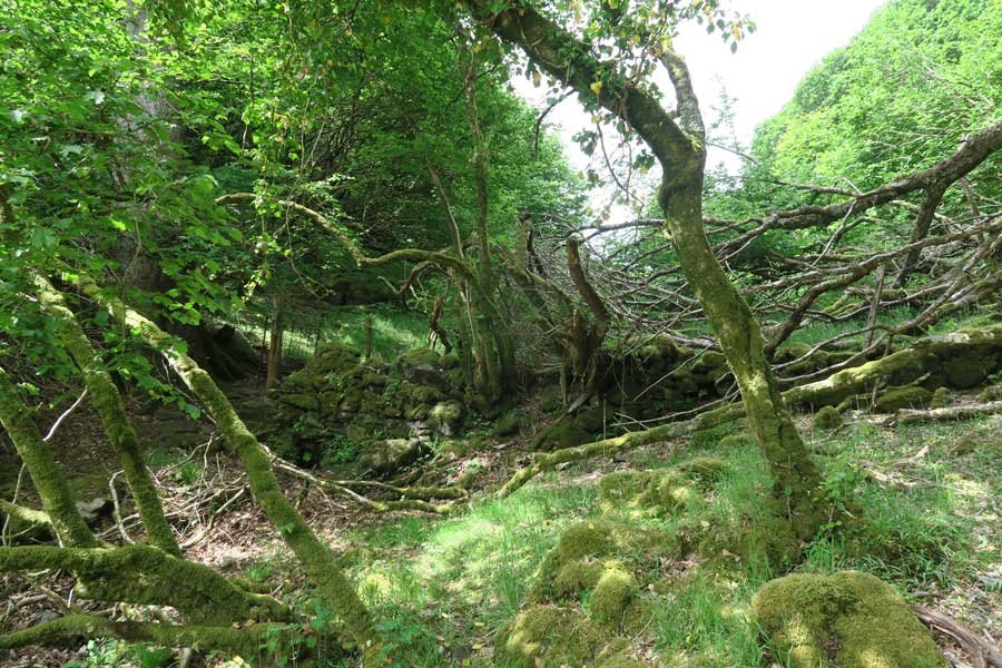
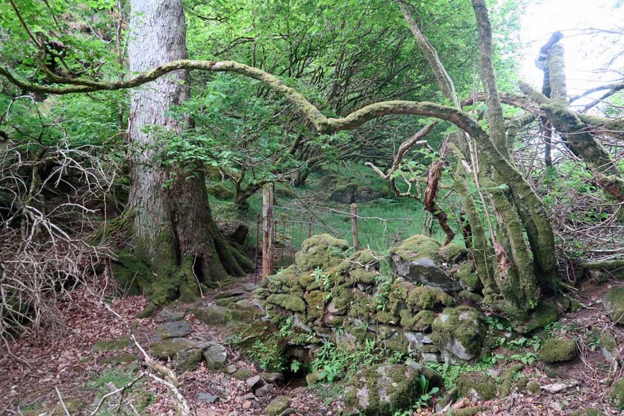
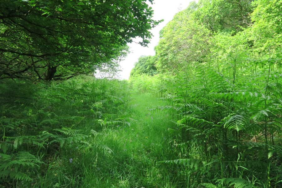
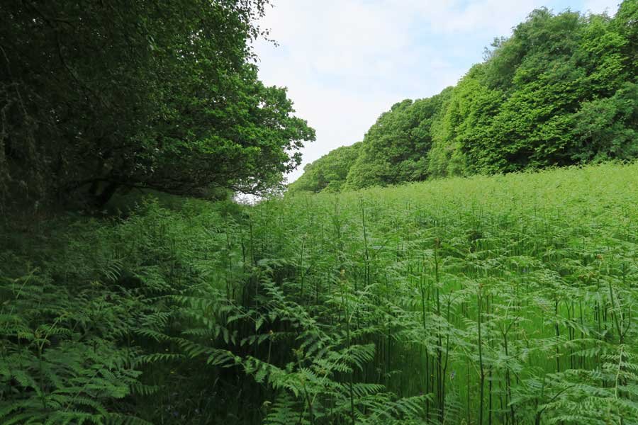
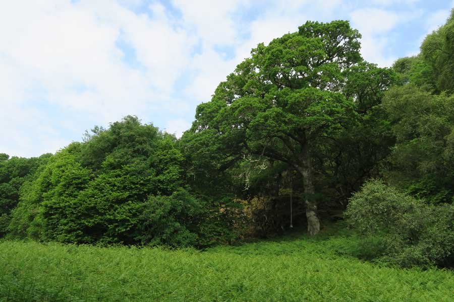
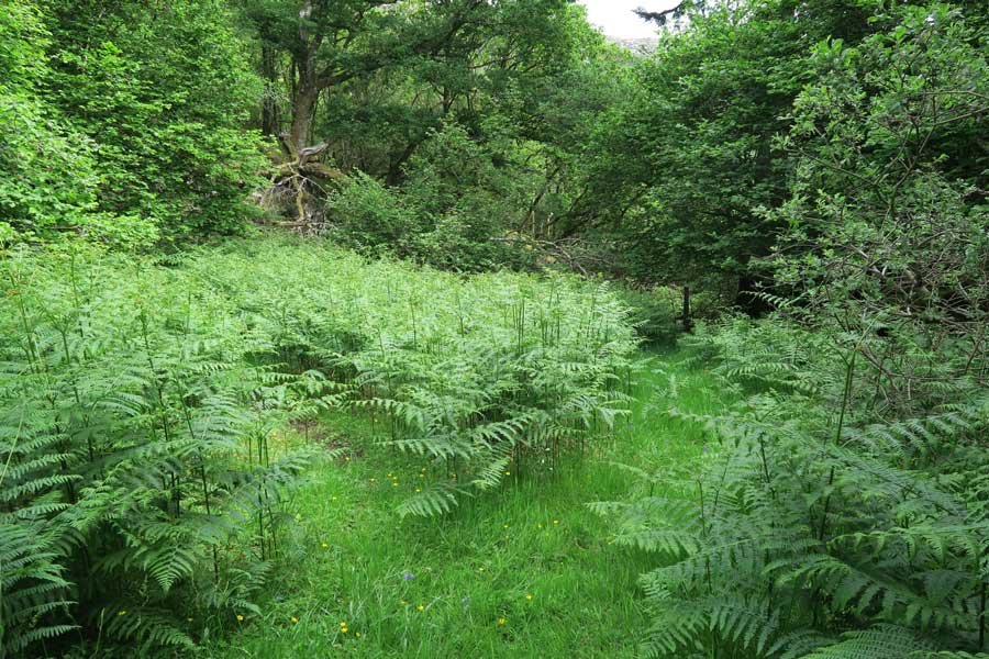
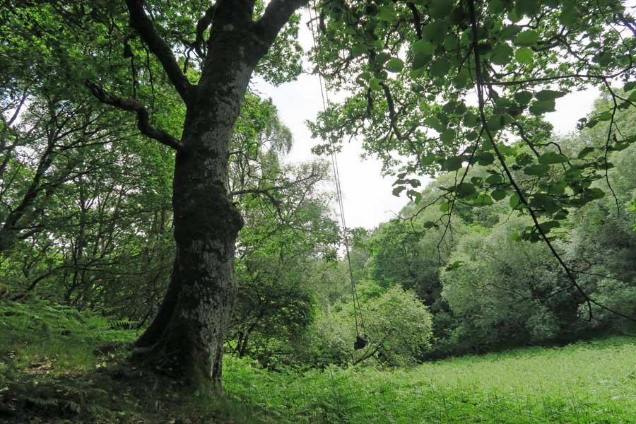
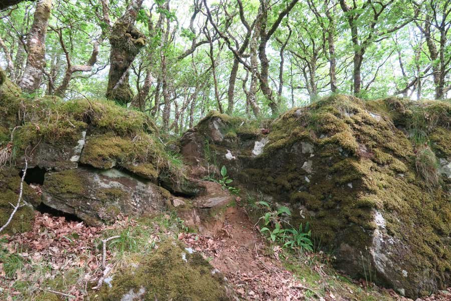
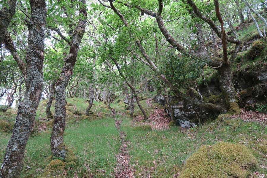
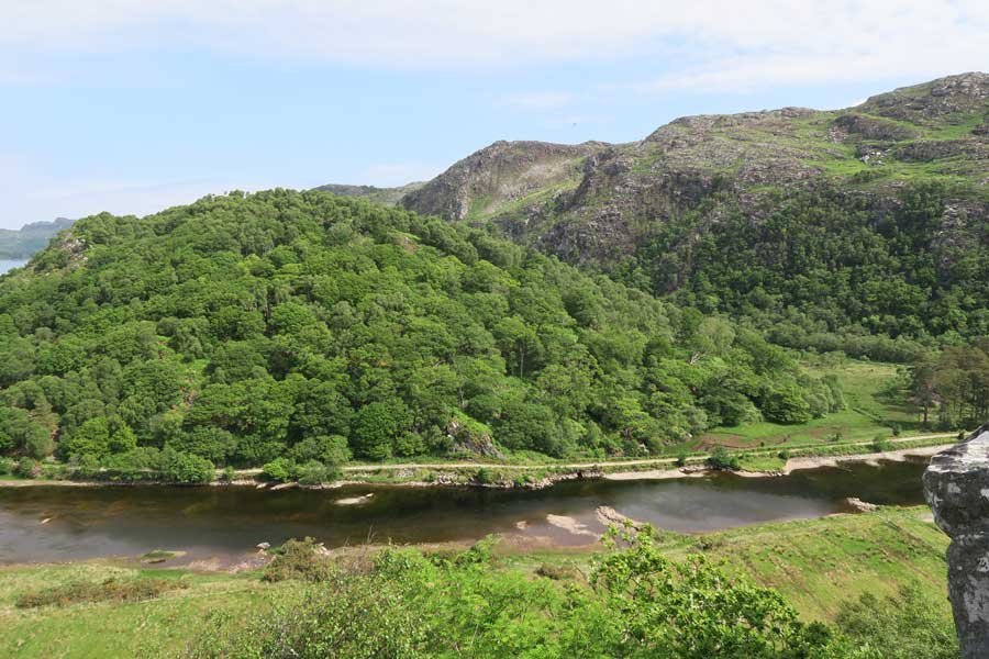
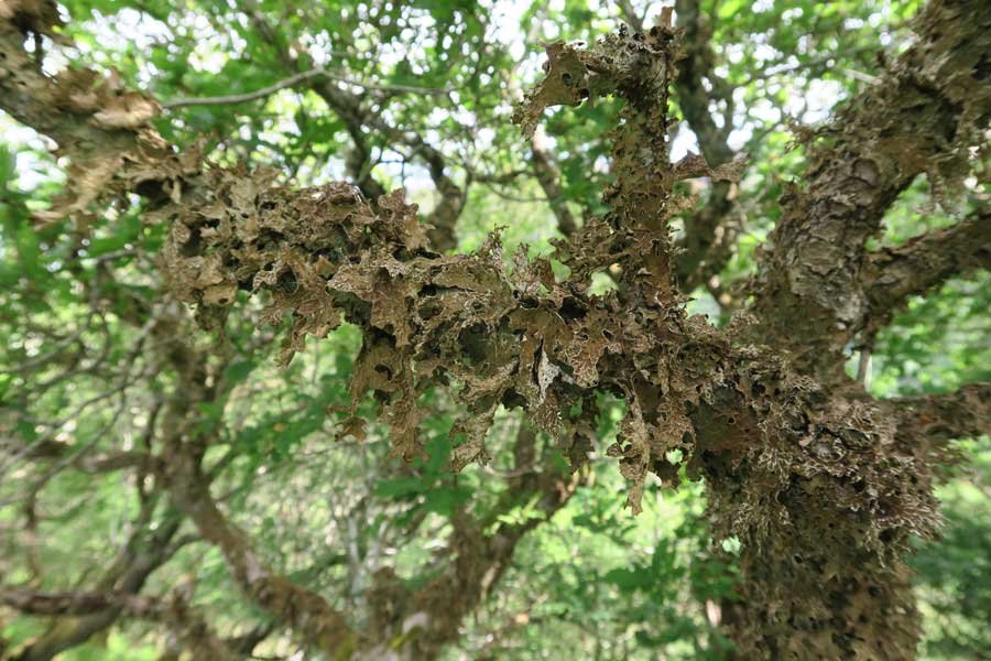
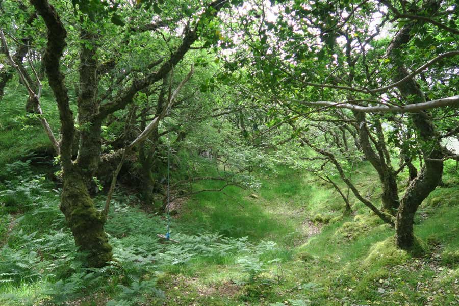
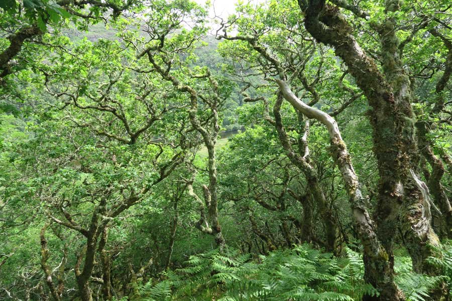
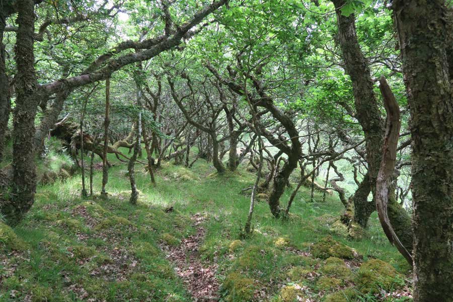
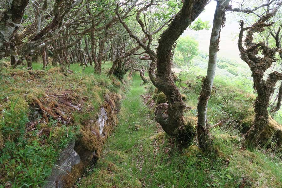
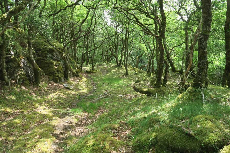
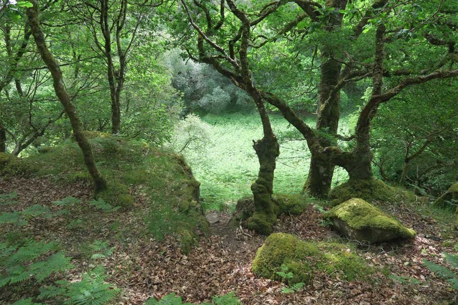
The route to the fortifactions on Shielfoot Torr passes through some lovely deciduous ancient woodland, dominated by gnarled, contorted and/or scrubby oaks which are heavily festooned with lichens. Other arboreal species include holly, birch, rowan, alder and hazel. There is a rich verdant ground flora of bryophytes and lichens, interspersed with clumps of greater woodrush, bilberry, heather bluebell and wood sorrel. It is thought that ShielfootTorr has been wooded since 5000 BC. Many of the trees have since been coppiced or pollarded, a testament to the traditional use of the woodland as a timber and forage resource in the past. Between the two summits of the Torr is an ancient meadow with a long history of cultivation.  Other evidence of past workings include charcoal burning platforms, a derelict 19th century cottage, a byre and a well.

The small collection of pre-historic fortifications include an oval shaped univallate fort consisting of a heavily vitrified wall which probably acted as a watch tower. There is also another walled structured attached to the main fort as evidenced by a tumbled stone wall and a small oval enclosure which probably once served as a small dun with timber-lace wall.

This is a magical place affording enchantment, stunning views, prehistoric fortfiications and captivating woodland. It is a great place to watch wildlife including golden eagles,. white tailed eagle and osprey from the high ridge. Look out for the stunning purple hairstreak in August amongst the oask canopy. A fabulous place and well worth a visit!

Route Details

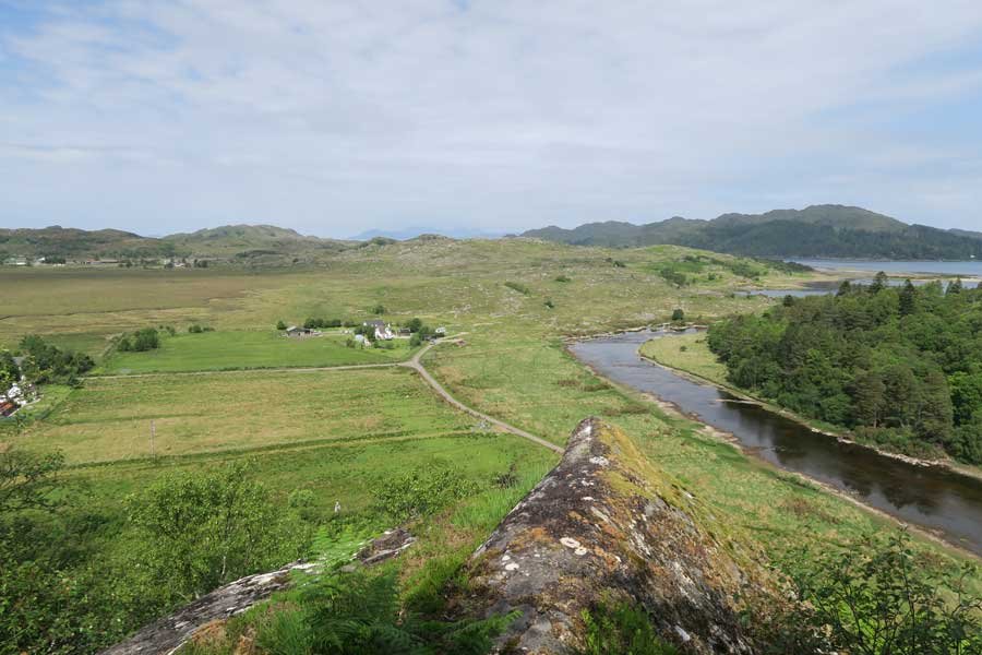
  1. Parking is limited on the Shielfoot road, though there is a small space at NM663696.  Alternatively, why not walk all the way from Acharacle, or cycle along the delightful wee road just off the A861 by The Shiel Bridge following the banks of the River Shiel.
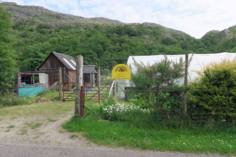
  2. The route starts on the east of the Shielfoot road just opposite Shielfoot Organics.  Head up the faint path to the left (south) of Bonn na Creige and the small shipping container, following the small stream through an old iron gate into the field between the two summits of The Torr.
  3. Follow the path through the field to the right and head up the hill keeping to the west side of the hill.
  4. Continue on the path up the west side of the hill to the summit.
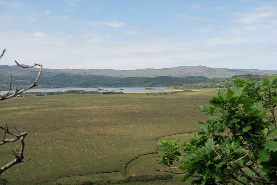
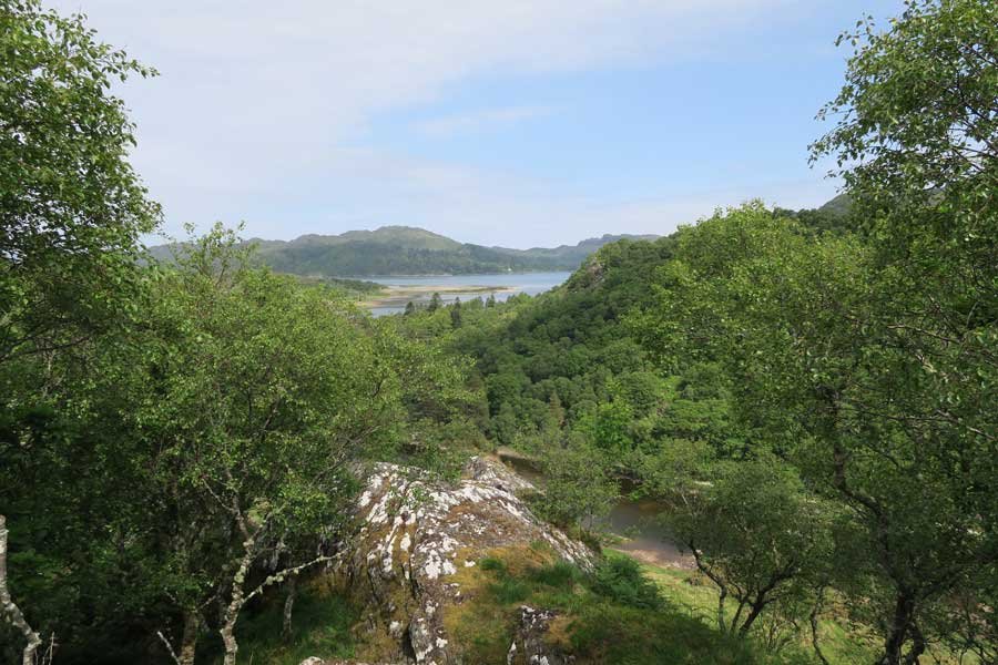
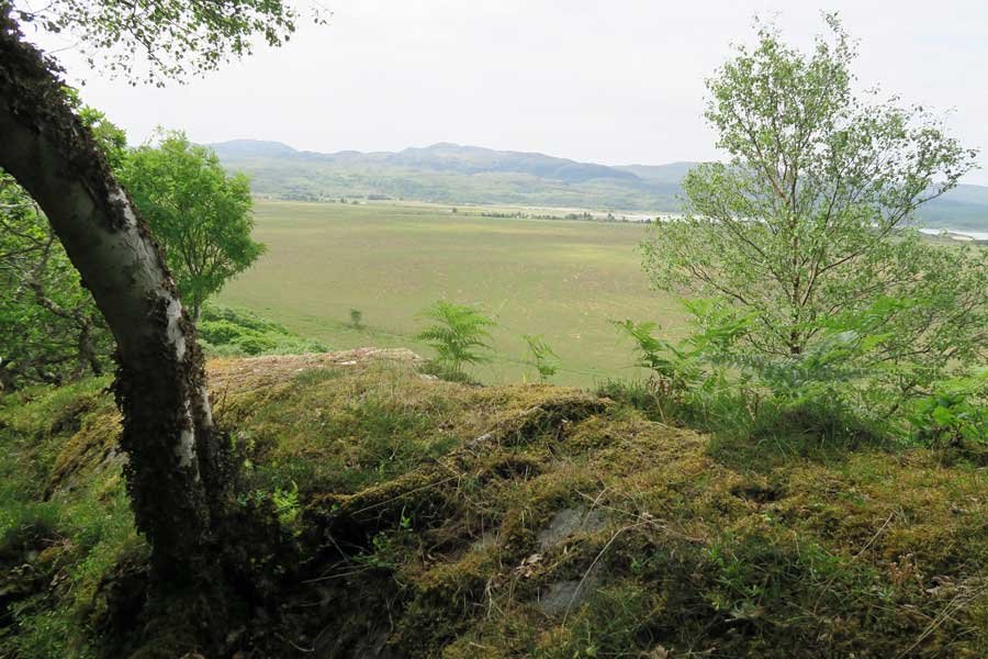
  5. Take time to explore the iron aged fortifications and dun at the top of the Torr and admire the views over The River Shiel and Kentra Bay.
  6. Return by the same route taking time to enjoy the ancient Atlantic Oak woodlands.

Location

starting grid ref: 

NM665670

parking grid ref: 

NM663696

Links to useful information

  • Vitirifed Fort at The Torr, Shielfoot - Moidart Local History Group
  • Shielfoot Torr - Canmore
  • The Torr, fort, dun and enclosure, Shielfoot


grade: 

  • moderate

terrain: 

woodland path

length: 

1 km (0.8 miles)

Type: 

  • there and back

Map: 

OS Explorer Map 390 - Ardnamurchan

OS Map

>>view map in full window


Google Map

Safety

Route details and information are provided in good faith.  All walking is potentially dangerous and it is your responsibility to ensure that you are properly dressed and equipped, have a map and compass, have checked and planned your route in advance and are able to navigate effectively.  Maps displayed on these walking pages are intended as an overview of the walk and are NOT suitable for navigation.  Please follow the Scottish Outdoor Access Code and respect landowners and residents' privacy.  Always check the weather forecast and let others know if you are walking in the hills.

Walking

  • Walking Overview
  • Map of All Walks
  • Ardnamurchan and Moidart
  • Arisaig, Mallaig and Glenfinnan
  • Fort William and Glen Nevis
  • Glencoe, Loch Leven & Argyll
Booking.com

Holiday Cottages in Fort William and Lochaber

Ardrhu Cottage
Ardrhu Cottage

Lochside cottage on the banks of Loch Linnhe in Onich with Glencoe mountains in the back ground.

Ardnamurchan Walking Pages

  • Alphabet Trail
  • Aoineadh Mor
  • Ardmolich Woodland Walk
  • Ardnastaing and Scotstown
  • Ardtornish Castle
  • Ariundle Oakwoods
  • Bay MacNeil Beach
  • Bay of Flies
  • Ben Hiant
  • Ben Resipole
  • Blain Burn Circular
  • Bourblaige Cleared Settlement
  • Camas nan Geall
  • Castle Tioram Circular
  • Castle Tioram Viewpoint
  • Claish Plantation
  • Corrantee Lead Mines from Ardnastaing
  • Corrantee Lead Mines from Polloch
  • Dalilea Walks
  • Dorlin Low Road
  • Fairy Walk
  • Fascadale and Port Eigin-aig
  • Galmadale Dam
  • Garbh Eilean Wildlife Walk
  • Ghardail Loop
  • Glen Moidart
  • Glenborrodale Nature Trail
  • Glendrian and Port Eigin-aig
  • Greadal Fhinn Chambered Cairn
  • Kentra Bay and The Singing Sands
  • Kentra Moss Circular
  • Kilmory Beach
  • Kinlochaline Low Road
  • Kinlochmoidart Old Road
  • Loch Teacuis Northside
  • Mingary Castle
  • Ockle to The Singing Sands
  • Polloch and Loch Shiel
  • Portuairk and Bay MacNeil
  • Portuairk to Sanna
  • Prince's Walk
  • Rahoy Hills - Black Water
  • Rahoy Hills - Loch Arienas
  • Salen Oakwoods
  • Shielfoot Torr
  • Silver Walk
  • Smirisary Walk
  • Sonachan Wood and Heathland
  • St Columba's Chapel, Drimnin
  • Strontian Community Woodland
  • Tennyson's Waterfall

Glencoe

Discover Glencoe

Glencoe and Loch Leven

>>

Walking

Walking

Take a Walk on The Wild Side...

with over 100 wildlife focused walks across Lochaber, you'll be spoilt for choice

>>

Fort William

Fort William

Fort William, The Outdoor Capital

>>

Wildlife

wildlife

Wildlife

Home to Scotland's Big Five, red deer, golden eagle, otter, red squirrel, seals and so much more. A Wildlife Adventure Awaits.

>>

Ardnamurchan

West Highland Peninsulas

Ardnamurchan and The West Highland Peninsulas

>>

Activities

Activities

Activities

kayaking, wildlife watching, cruising, cycling, golfing, climbing, skiing, slow adventures and many more things to do

>>

Road to The Isles

The Road to The Isles

The Road to The Isles

>>

Day Trips

Day trips

Day Trps

Take off for the day to see the puffins on The Treshnish Isles, A Day trip to Mull, Skye, The Small Isles, The Most westerly point on the mainland and many more local ideas for a day out

>>

  • Advertising
  • Contact
  • Disclaimer
  • Privacy Policy

Photos and Content Copyright ©2011-2025 Wild About Lochaber - All Rights Reserved

  • Wild About Lochaber on Instagram
  • Wild About Lochaber on FaceBook
  • Wild About Lochaber on Twitter