Wild About Lochaber

Wild About Lochaber

where great adventures begin...

Search form

Menu

  • Home
  • Explore
    • Wild Lochaber
    • Ardnamurchan, Moidart & Morvern
    • Fort William and Glen Nevis
    • Glencoe and Loch Leven
    • The Road To The Isles
    • #WildLochaber Photo Gallery
  • Accommodation
    • Self Catering
    • Caravan & Campsites
    • Hotels and B&Bs
  • Walking
    • Map of All Walks
    • Ardnamurchan and Moidart
    • Arisaig Mallaig and Glenfinnan
    • Fort William and Glen Nevis
    • Glencoe, Loch Leven & Argyll
  • Wildlife
    • Map of Wildlife Sites
    • Wildlife Experiences
    • Wildlife Habitats
  • Things To Do
    • Activity Providers
    • Beaches
    • Castles
    • Destinations
    • Gardens
    • Geology
    • Geopark Rock Route
    • Historic Attractions
    • Museums and Interpretation
    • Railways
    • Wildlife Experiences
    • Wildlife Hotspots
  • Travel
    • Electric Vehicle Charging Points
    • Ferries
    • Petrol Stations
    • The Caledonian Sleeper
  • What's On
    • Calendar
    • Arts, Culture and Community Events
    • Family Friendly Events
    • Walking Events
    • Wildlife & Geology Events
    • Events on Discover Glencoe
    • Road to The Isles & Ardnamurchan
  • Blogs
    • Ardnamurchan Area Blogs
    • Glencoe Area Blogs
    • Lochaber Blogs
    • West Coast Island Blogs
    • Wild About Lochaber Blog

Bourblaige Cleared Settlement

  • Bourblaige Cleared Settlement
  • Parking space on the B8007
  • The start of the track to Bourblaige
  • The track to Bourblaige
  • Heritage Ardnamurchan signage at teh entrance to the field
  • Heritage Ardnamurchan signage at teh entrance to the field
  • Cross the large grassland pasture to Bourblaige
  • You can follow the fenceline down to the village, though it is boggy
  • You can follow the fenceline down to the village, though it is boggy
  • Bourblaige cleared village
  • From Bourblaige you can head down the Loch Sunart
  • Crossing a small stream on the way down to Loch Sunart
  • Following the fenceline down to the coast
  • Following the fenceline down to the coast
  • Keeping to the east of the hill on the way back
  • Keeping to the east of the hill on the way back
  • orchid rich grassland at Bourblaige
  • wild thyme on the dryer tussocks at Bourblaige
  • A Beautiful Demoiselle damselfly at Bourblaige
  • Orchid rich damp pastures at Bourblaige
  • harebells at Bourblaige
  • ragged robin at Bourblaige
  • Bourblaige Cleared Settlement
  • A great spot for butterfly bagging
  • female keeled skimmer dragonfly in the damp grassland at Bourblaige
  • a four spotted chaser dragonfly at Bourblaige
  • golden ringed dragonfly at Bourblaige
  • The road to Ardnamurchan...

Details

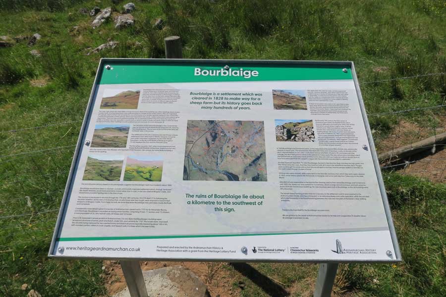
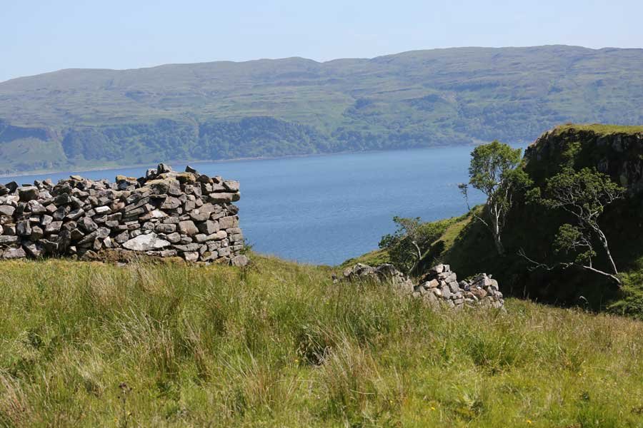
An interesting walk to the small halmet/clachan of Bourbliage located on the southern shore of the Ardnamurchan peninusula on the south-east flank of Ben Hiant, between Camus nan geall and Macleans' Nose. The settlement occupies a 14 acre site, between 100 and 150 metres above sea level and lies at the confluence of some minor tributaries. The settlement may also be the site of the Battle of Muirbulg which was fought in 731 between the Picts and the Dalriadic Scots.

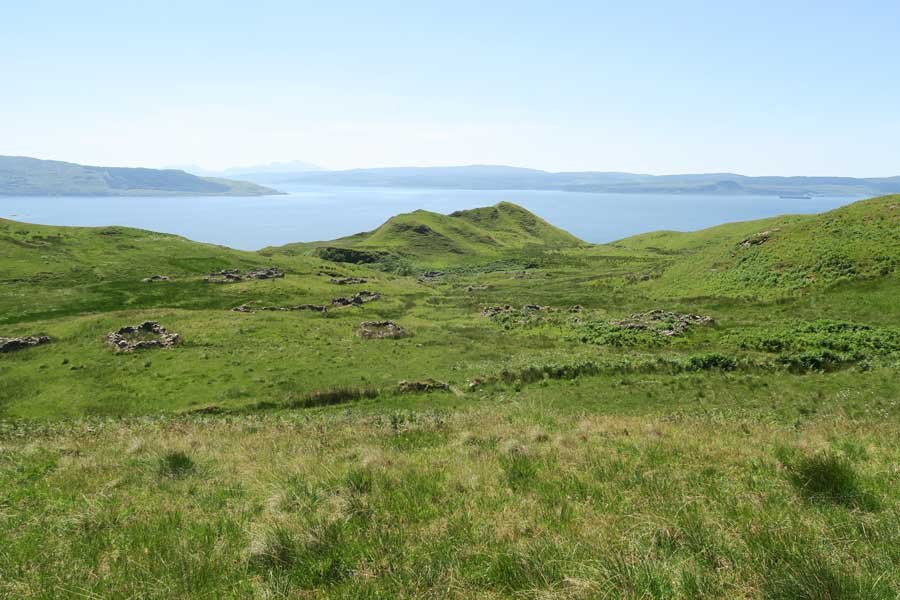
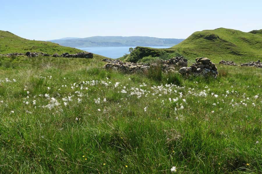
The village (clachan) consists of the remains of around 36 unroofed buildings of drystone construction (dwelling houses, barns, byres), two enclosures, a field system and a head dyke. The settlement was cleared in 1828 by the landowner, Sir James Riddell, with the land given over to sheep grazing.

The settlement/clachan has been designated as a monument of national importance by Historic Environment Scotland (HES) on account of the state of preservation of many of its buildings and the 'complex architectural information' which provide valuable insights into 'the way of life and the architecture of post-Medieval communities in this area of Scotland.

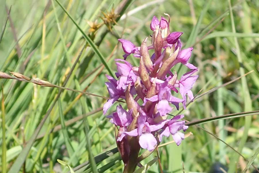
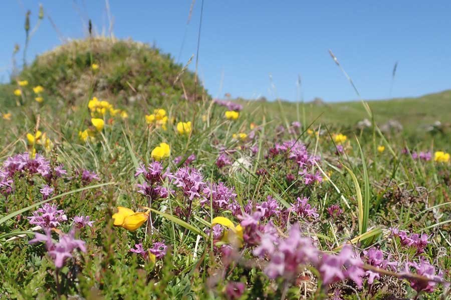
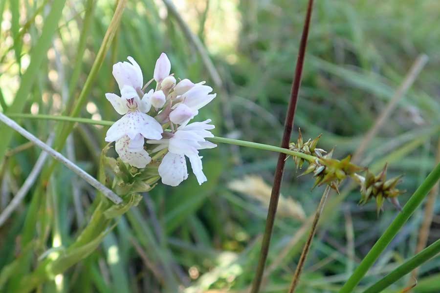
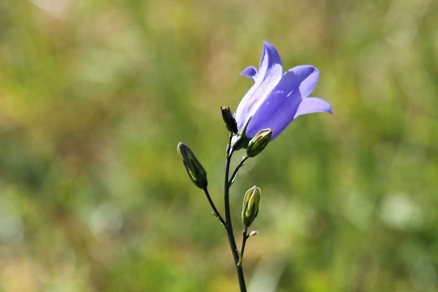
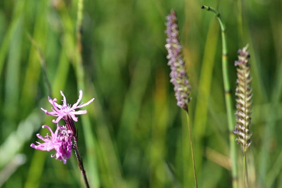
The walk also affords some good opportunities for botanising and wildlife spotting. The species-rich damp grassland/heath with its drier mounds/rocky outcrops and wet flushes supports a variety of plants, including self heal, thyme, common sorrel, harebell, lady's mantle, common cat's-ear, white clover, red clover, yarrow, St John's wort, bird's foot trefoil, fragrant orchid, heath spotted orchid, northern marsh orchid, primrose, devil's bit scabious, lousewort, bluebell, cuckoo flower heather, bell heather, heath bedstraw, milkwort and tormentil. Carnivorous plants include round leaved sundew and butterwort.

In the wetter areas, look out for cross-leaved heath, yellow flag iris, meadow sweet, cotton grass, marsh valerian, marsh thistle, creeping buttercup, ragged robin, bog asphodel, bog myrtle, marsh lousewort, marsh marigold and water forget-me knot. The remains of the buildings also support patchworks of crustiose lichens.

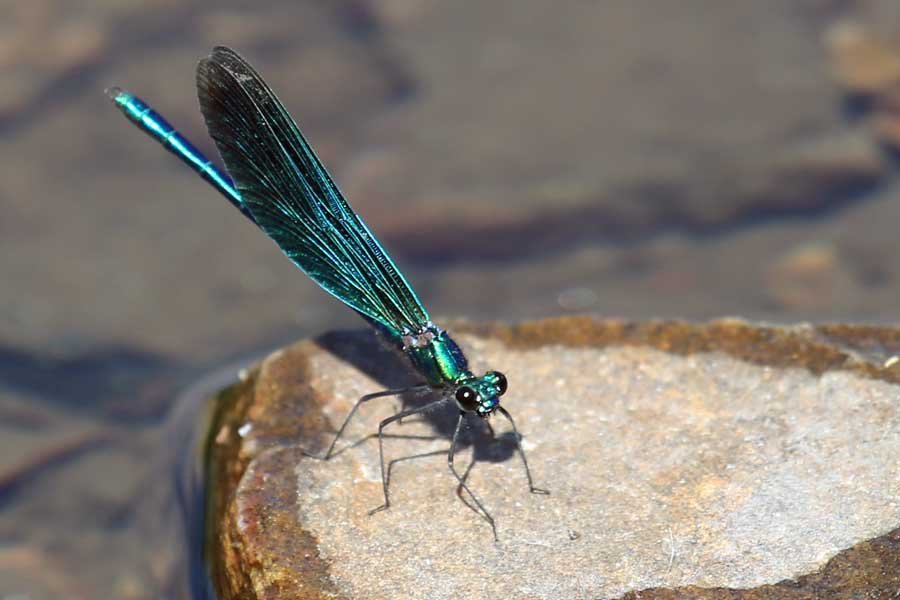
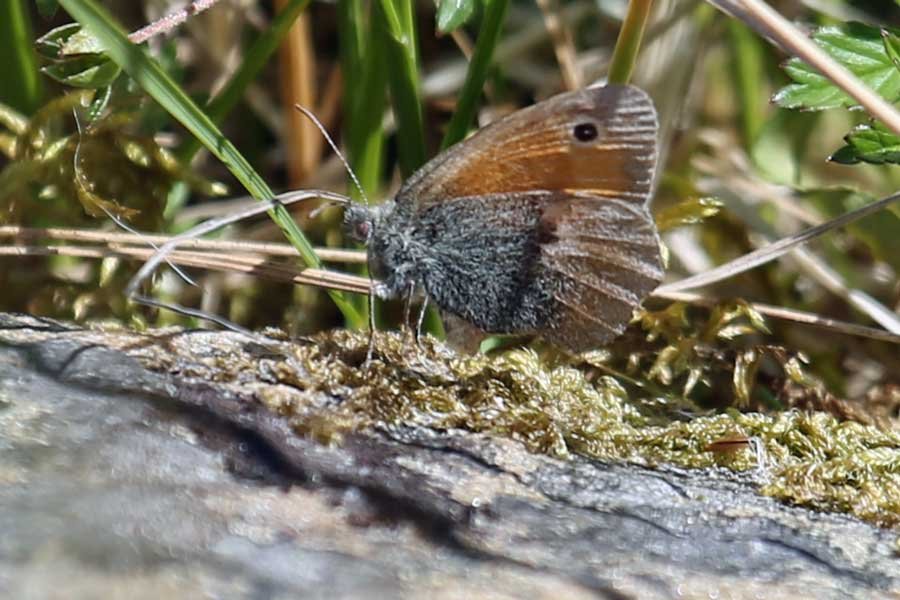
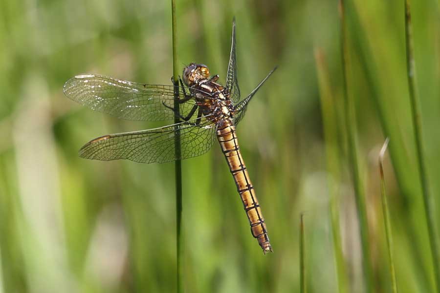
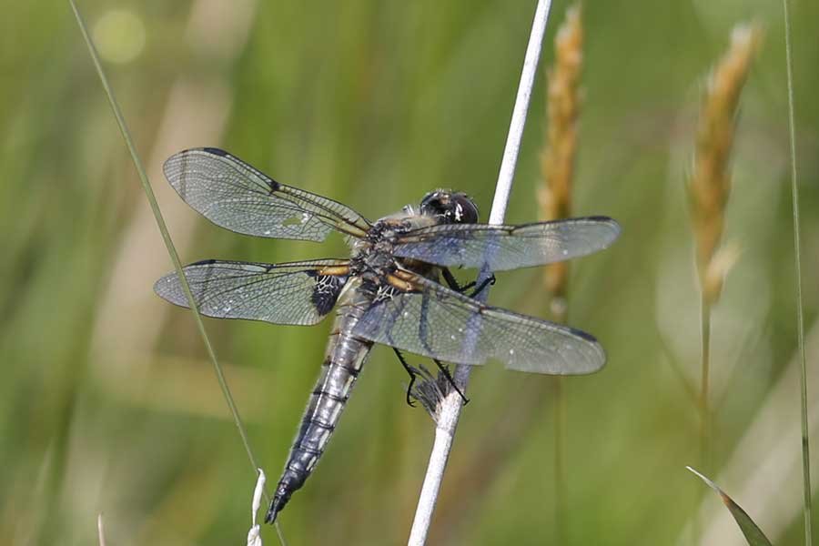
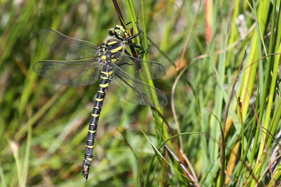
Butterflies and moths you may see on route include migrants such as red admiral, painted lady and silver Y moth, as well as orange tip, green-veined white, small white, common blue, small heath and meadow brown. Damselflies include large red and the beautiful demoiselle. Look out for one of Brittan's largest dragonflies, the striking golden-ringed dragonfly, with its black and yellow abdomen and bright green eyes, as well as numerous four spotted chasers.

Listen out for wheatear, meadow pipits, stonechat and skylark in the vicinity of the settlement. This is also a good place to see red deer in the surrounding hills and golden eagle soaring above the crags around Ben Hiant, as well as white-tailed eagle.

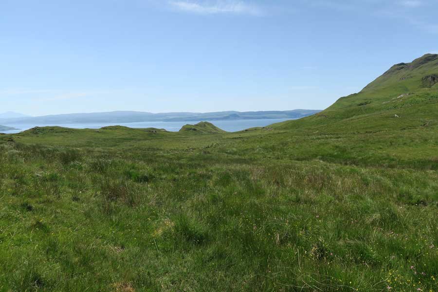
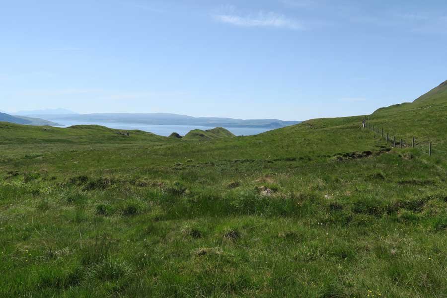
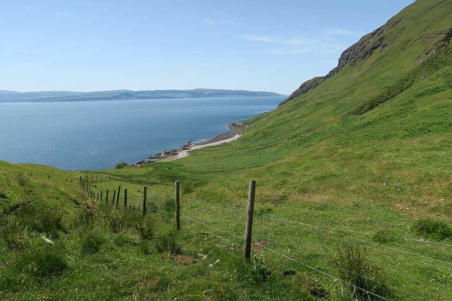
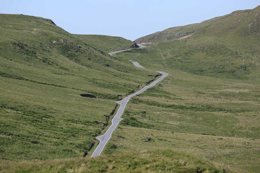
The site also affords some fine coastal and hill views of Morvern and Mull across the Sound of Mull.

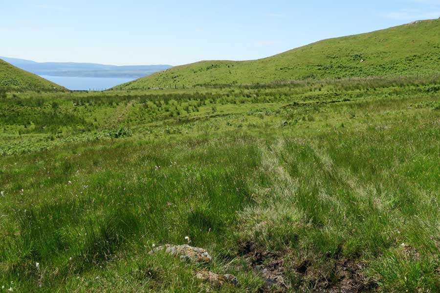
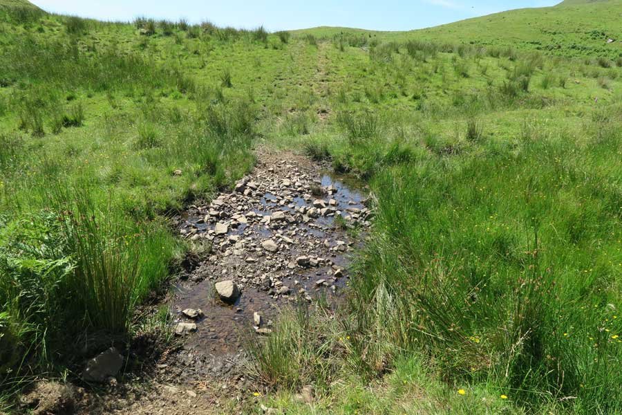
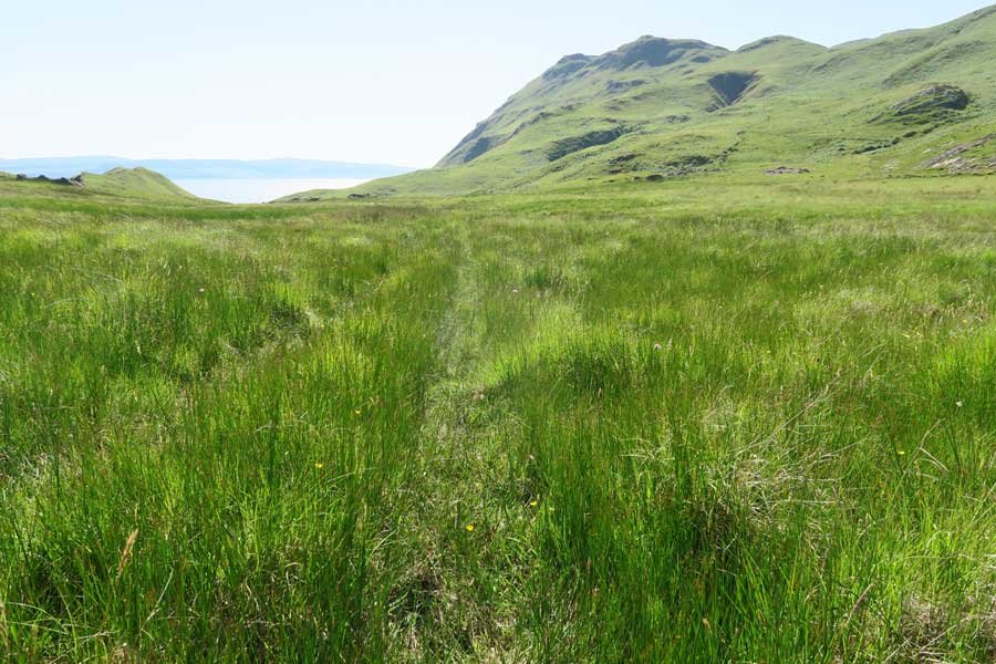
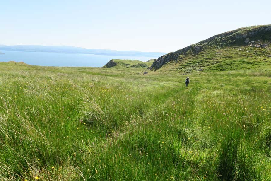
Please note that the walk is mainly across rough uneven damp grassland with boggy areas. You can also head down towards the coast (shingle beach) if desired. Stout shoes are essential.

Route Details

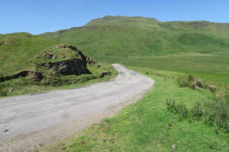
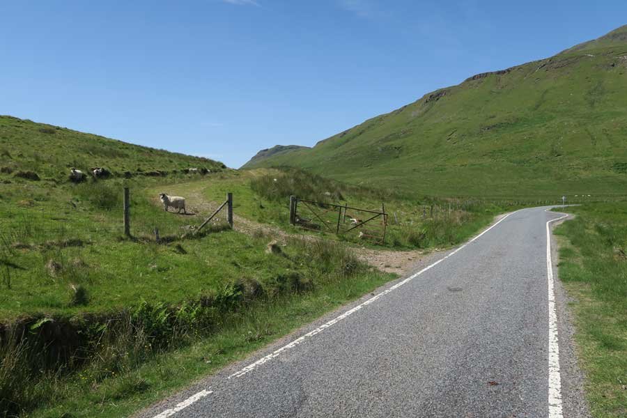
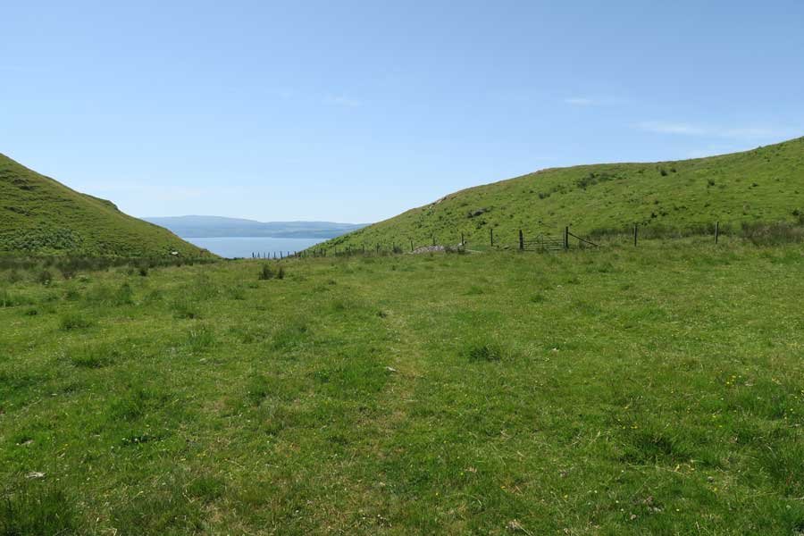
  1. Once past Camus nan Geall, look out for some off road parking by the side of the B8007, within walking distance of a short track on the south-west of the road, the access point to the village from above.
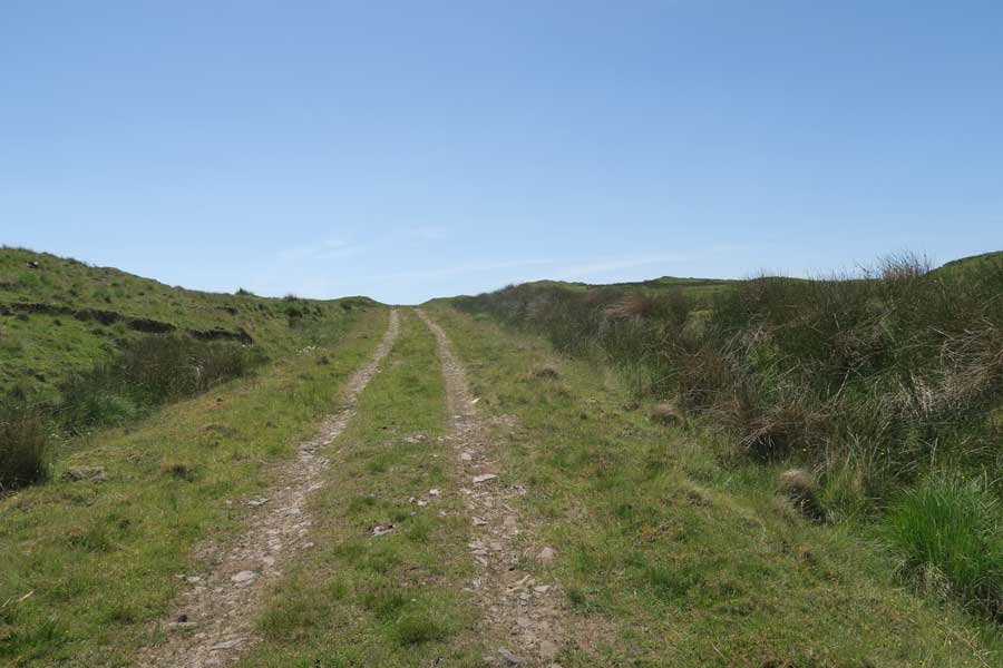
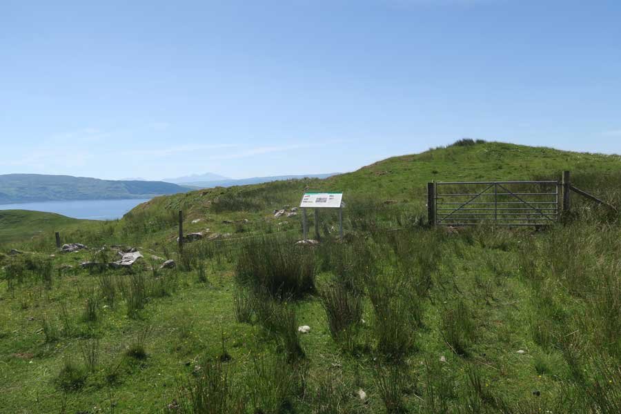
  2. From the B8007, walk up the track where you will find an interpretation board on the settlement of Bourblaige by the gate to the field.
  3. Pass through the metal gate and walk along the fencelike to the right until you see the ruined houses and then head towards the settlement of Bourblaige. The path can be very boggy and uneven.  Alternatively, pass to the south of the small hill in front of the gate and follow a faint track down through the field to the village (see map for approximate route).
  4. Take time to explore this interesting settlement, which is one of the best preserved cleared settlements on the Ardnamurchan peninsula.
  5. You can also extend the walk by heading down towards the coast where there is a good chance of seeing golden eagle soaring over the crags.
  6. Return by the same route or alternatively join the Camus nan Geall walk eastwards along the shores of Loch Sunart.

Location

starting grid ref: 

NM555629

Links to useful information

  • Bourblaige History Page
  • Camus nan Geall walk

grade: 

  • moderate

terrain: 

path and field

length: 

2.6km (1.6 miles)

Type: 

  • there and back

Map: 

OS Explorer Map 390 - Ardnamurchan

OS Map

>>view map in full window

Google Map

Safety

Route details and information are provided in good faith.  All walking is potentially dangerous and it is your responsibility to ensure that you are properly dressed and equipped, have a map and compass, have checked and planned your route in advance and are able to navigate effectively.  Maps displayed on these walking pages are intended as an overview of the walk and are NOT suitable for navigation.  Please follow the Scottish Outdoor Access Code and respect landowners and residents' privacy.  Always check the weather forecast and let others know if you are walking in the hills.

Walking

  • Walking Overview
  • Map of All Walks
  • Ardnamurchan and Moidart
  • Arisaig, Mallaig and Glenfinnan
  • Fort William and Glen Nevis
  • Glencoe, Loch Leven & Argyll
Booking.com

Holiday Cottages in Fort William and Lochaber

The Logs - self catering for 10
The Logs

A detached Norwegian log house in a quiet rural setting sleeping 10, situated 3 miles north of Fort William and within easy reach of The Nevis Range

Ardnamurchan Walking Pages

  • Alphabet Trail
  • Aoineadh Mor
  • Ardmolich Woodland Walk
  • Ardnastaing and Scotstown
  • Ardtornish Castle
  • Ariundle Oakwoods
  • Bay MacNeil Beach
  • Bay of Flies
  • Ben Hiant
  • Ben Resipole
  • Blain Burn Circular
  • Bourblaige Cleared Settlement
  • Camas nan Geall
  • Castle Tioram Circular
  • Castle Tioram Viewpoint
  • Claish Plantation
  • Corrantee Lead Mines from Ardnastaing
  • Corrantee Lead Mines from Polloch
  • Dalilea Walks
  • Dorlin Low Road
  • Fairy Walk
  • Fascadale and Port Eigin-aig
  • Galmadale Dam
  • Garbh Eilean Wildlife Walk
  • Ghardail Loop
  • Glen Moidart
  • Glenborrodale Nature Trail
  • Glendrian and Port Eigin-aig
  • Greadal Fhinn Chambered Cairn
  • Kentra Bay and The Singing Sands
  • Kentra Moss Circular
  • Kilmory Beach
  • Kinlochaline Low Road
  • Kinlochmoidart Old Road
  • Loch Teacuis Northside
  • Mingary Castle
  • Ockle to The Singing Sands
  • Polloch and Loch Shiel
  • Portuairk and Bay MacNeil
  • Portuairk to Sanna
  • Prince's Walk
  • Rahoy Hills - Black Water
  • Rahoy Hills - Loch Arienas
  • Salen Oakwoods
  • Shielfoot Torr
  • Silver Walk
  • Smirisary Walk
  • Sonachan Wood and Heathland
  • St Columba's Chapel, Drimnin
  • Strontian Community Woodland
  • Tennyson's Waterfall

Glencoe

Discover Glencoe

Glencoe and Loch Leven

>>

Walking

Walking

Take a Walk on The Wild Side...

with over 100 wildlife focused walks across Lochaber, you'll be spoilt for choice

>>

Fort William

Fort William

Fort William, The Outdoor Capital

>>

Wildlife

wildlife

Wildlife

Home to Scotland's Big Five, red deer, golden eagle, otter, red squirrel, seals and so much more. A Wildlife Adventure Awaits.

>>

Ardnamurchan

West Highland Peninsulas

Ardnamurchan and The West Highland Peninsulas

>>

Activities

Activities

Activities

kayaking, wildlife watching, cruising, cycling, golfing, climbing, skiing, slow adventures and many more things to do

>>

Road to The Isles

The Road to The Isles

The Road to The Isles

>>

Day Trips

Day trips

Day Trps

Take off for the day to see the puffins on The Treshnish Isles, A Day trip to Mull, Skye, The Small Isles, The Most westerly point on the mainland and many more local ideas for a day out

>>

  • Advertising
  • Contact
  • Disclaimer
  • Privacy Policy

Photos and Content Copyright ©2011-2023 Wild About Lochaber - All Rights Reserved

  • Wild About Lochaber on YouTube
  • Wild About Lochaber on Pinterest
  • Wild About Lochaber on Instagram
  • Wild About Lochaber on FaceBook
  • Wild About Lochaber on Twitter
Share/Save