


Nevis Gorge and An Steall
A lovely walk through the steep-sided Nevis Gorge to an impressive waterfall, An Steall, cascading from a hanging valley (Coire A’ Mhail). This is a very impressive short walk with much geological and botanical interest, as well as stunning mountain views of the slopes of Ben Nevis, and some of the mountains of The Mamores. The lower slopes are variously clad with woodland (dominated by birch at the higher altitudes) merging into heath and upland grassland and onto bare summit and scree slopes.
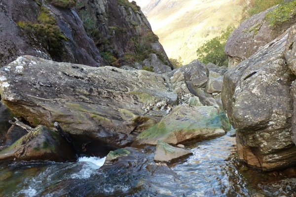
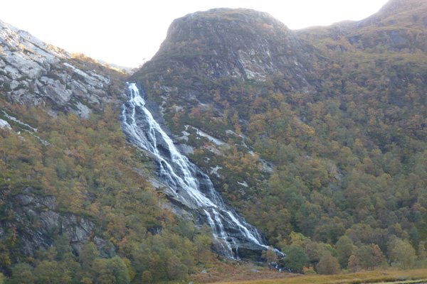
This is an area of massive upheaval, igneous intrusions and glaciation events, producing a stunning geomorphology. The walk traverses a bedrock of Precambrian Dalradian fine-grained metamorphic sedimentary rocks (known as the Leven Schists), with some exposures of the red inner granite of the Ben Nevis range. Glacial moraines of unsorted alluvium deposits are also visible on route. The gorge is also peppered with large potholes gouged out of the schist (the latter visible at low waters) and an array of large boulders reflecting the turbulent glacial history of this formerly vast and fast flowing meltwater river. The waterfall emerges from the hanging valley, Coire a' Mhail, produced by differential erosion by two adjacent glaciers, and plunges 120m over quartzite to produce an impressive sight.
The walk passes through mixed ancient woodland, clinging to the steep sides of the gorge. The species include alder, ash, birch, elm, aspen and Scots pine. There are some particularly fine specimens of Scots pine dotted over the hillsides, as well as some fine stands of hazel. Understory species include heathers (Calluna vulgaris, Erica tetralix, E. cinerea), bilberry (Vaccinium myrtilus), wood sorrel (Oxalis acetosella), primrose (Primula vulgaris), goldenrod (Solidago virgaurea), wood sage (Teucrium scorodonia), hard fern (Blechnum spicant), shield ferns (Dryopteris spp) and violets (Viola spp) according to local edaphic conditions, with purple moor grass (Molina caerula), bog asphodel (Narthecium ossifragum), meadowsweet ((Filipendula ulmaria), cotton grass (Eriophorum angustifolium) and a diversity of sedges and rushes in the wetter sections.
The trees and boulders are variously strewn with bryophytes and lichens (especially communities of parmelion and usneion) according to local conditions. Diverse assemblages of graphidion communities can be found associated with the hazel groves. Gullies also abound with mosses and liverworts This is a truly magic place.
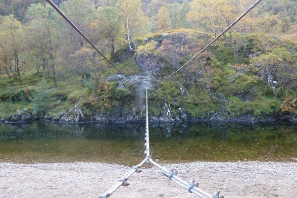
The wooded section traverses the steep-sided gorge and affords occasional glimpses of the river, which can be seen crashing and weaving around large boulders beneath. The final section of the walk passes through an upland meadow, adjacent to the river, passing by the infamous wire pedestrian bridge, a mountaineering hut and some early 18th century shepherds’ dwellings.
Look out for a range of woodland birds, including tits, warblers, finches and tree pipits, as well as raptors and corvids in the hills (including golden eagle and raven). Scan the river for dippers and sandpipers. Look out for the tracks and signs of pine marten.
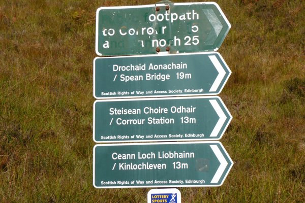
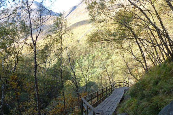
There is an interpretation board at the start of the route, introducing the walk, wildlife and geology. The path is well defined, but uneven and slippery in places, with some scrabbling over rocks and some vertiginous sections. There are several stream-crossings on route. There is also a short wooden boardwalk section with steps that serves as a good viewing platform. The route is the access point for several other paths, so it can be very busy during the peak season.
The path begins at a large car park at the end of the Glen road, where the waterslide on the southern flank of Ben Nevis (draining from Coire Eoghainn) is particularly impressive after heavy rain. The water flows over granitic rock (inner granite) for over 350 metres.
Route Details
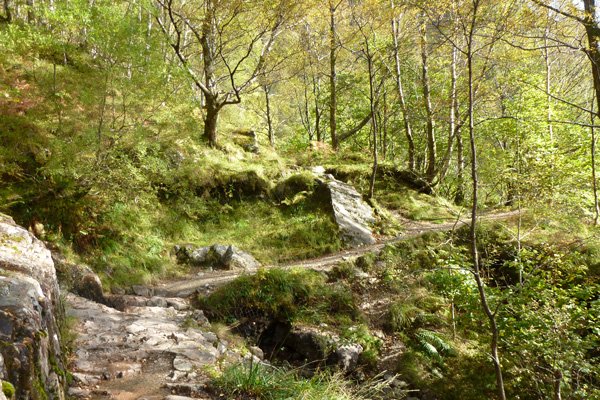
Park at the car park and take the gravel/stone path by the interpretation board. The path traverses the steep sided gorge of the Water of Nevis through ancient woodland. The path ascends gradually and there are several stream-crossings on route.
A boardwalk section with steps and a handrail helps you to negotiate a steep rocky section. Just before you reach the wooden boardwalk, look out for the magnificent Scots pine clinging precariously to the steep slope.
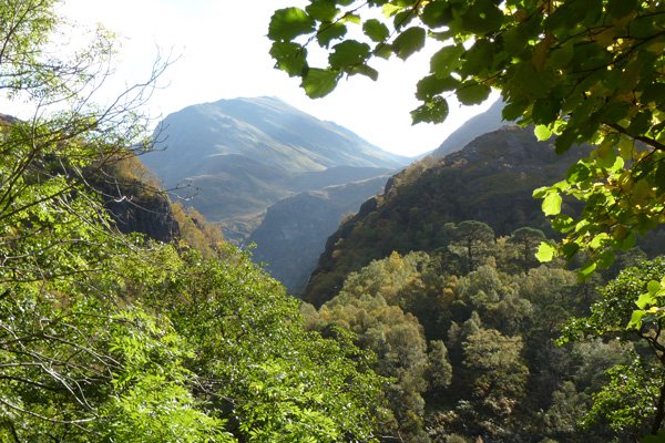
There are fabulous views of the surrounding hills on route through gaps in the trees and tantalising glimpses of An Steall Falls in the distance.
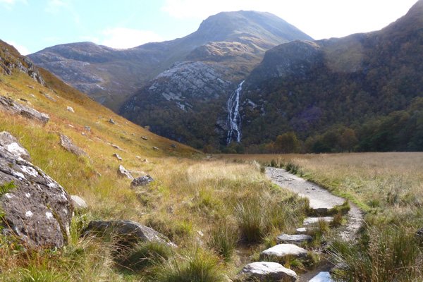
Soon the valley broadens out as you emerge from the woodland. Magnificent views are afforded of An Steall falls at this stage, cascading from a hanging valley over white quartzite, and framed by birch woodland, with the peak of An Gearnach towering above.
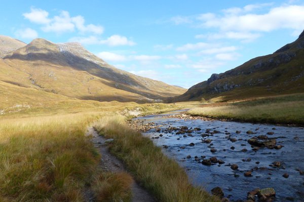
The path heads towards the waterfall, close by the river, Water of Nevis, with its shingle banks, merging into upland wet meadow and surrounded by wooded slopes. There are some more stream crossings on route.
Continue passed the path to the infamous wire bridge which crosses the river to a mountain hut. This can be crossed on your return if desired to get a closer look at the Falls. However, the crossing is best done at low water and requires good balance and a brave heart. It should only be crossed if you feel competent to do so, and with a maximum of two persons on the bridge at any one time.
The path continues by the waterfall through this lovely glacial U-shaped valley on a grassy/muddy, well defined path through upland meadow with some willow encroachment and isolated mature alder, birch, rowan and willow trees.
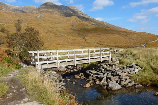
Continue to the wooden bridge, beyond which there are some derelict early 18th century stone buildings and a cairn.
Take time for a picnic or just enjoy the fabulous views of birch clad hills interspersed with scree slopes. When ready, return by the same route, taking a detour across the wire bridge, if desired.
starting grid ref
terrain
length
Safety
Route details and information are provided in good faith. All walking is potentially dangerous and it is your responsibility to ensure that you are properly dressed and equipped, have a map and compass, have checked and planned your route in advance and are able to navigate effectively. Maps displayed on these walking pages are intended as an overview of the walk and are NOT suitable for navigation. Please follow the Scottish Outdoor Access Code and respect landowners and residents' privacy. Always check the weather forecast and let others know if you are walking in the hills.


