


Cow Hill
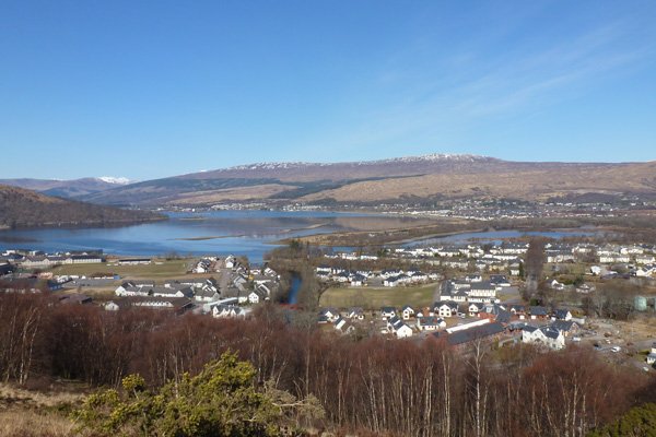
This is a fabulous walk, affording some stunning views of the Ben Nevis Range , Loch Linnhe and Loch Eil and the township of Fort William and its environs.
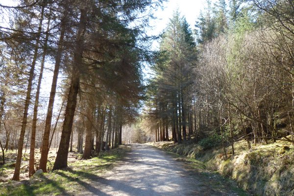
The walk passes through some lovely sections of deciduous woodland, forestry plantation and heathland. The deciduous woodland includes hawthorn, ash, alder, beech, holly, rowan, hazel and birch, with understorey vegetation consisting of gorse (Ulex europaeus), hard fern (Blechnum spicant), male fern (Dryopteris spp), purple moor grass (Molinia caerulea), foxglove (Digitalis purpurea), primrose (Primula vulgaris) and heather (Calluna vulgaris), with sedges, rushes and bryophyte assemblages in the wetter areas. The forest plantation consists of mainly larch and spruce with a ground flora of heather (dominated by Calluna vulgaris) and bryophyte assemblages. The heathland consists of Calluna vulgaris assemblages, with some encroachment by gorse and birch.
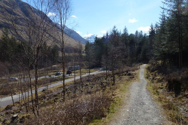
The walk can be started by the leisure centre in Fort William or alternatively at the Braveheart Car-park in Glen Nevis just south-west of Fort William.
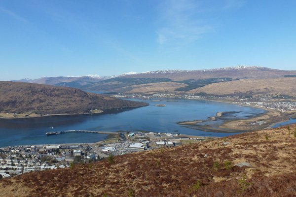
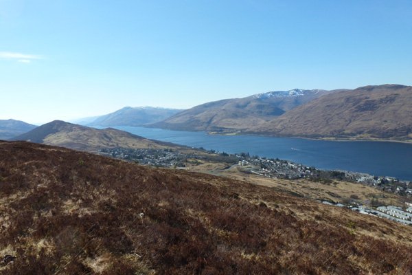
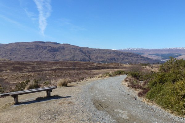
There are welcome benches, viewpoints, interpretation boards and picnic benches (the latter at the Brave heart Car-park) on route. One viewpoint, Sugar Loaf Hill, is where cannonballs were fired in the unsuccessful siege of Fort William during the Jacobite uprising of 1745. There are also some fabulous views of the Ben Nevis Range, Loch Linnhe and Loch Eil and the township of Fort William and suburbs of Coal and Corpach from Cow Hill Summit viewpoint.
The artist studio and field station, Outlandia, can also be accessed via a boardwalk. The studio is situated in spruce plantation overlooking the Ben Nevis Range and is designed to ‘foster links between creativity and the environment’.
A fabulous walk for a fine day.
Route Details
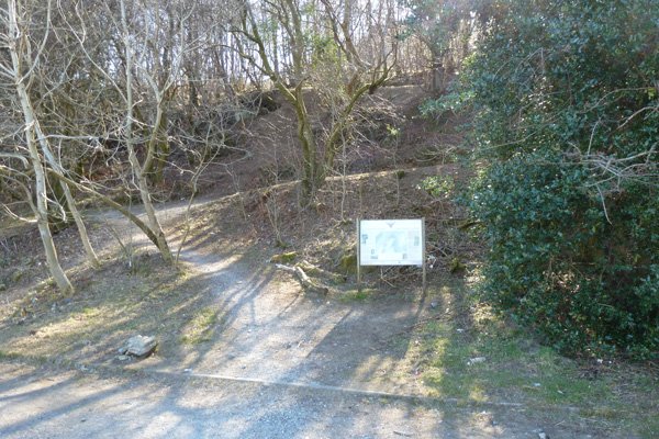
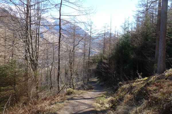
- Park at the rear of the Leisure Centre. There is an interpretation board at the start of the walk providing information on the history of the site and details of walk. Head up the hill through deciduous woodland of mainly birch, keeping left.
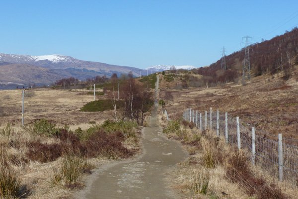
- The path eventually emerges from the birch woodland to open heath affording fine views of Fort William, Loch Linnhe and the surrounding hills. Take a slight detail to a viewpoint with a welcome bench (Sugar Loaf Hill) to admire the views. The viewpoint of Sugar Loaf hill provides fine views of Fort William, Loch Linnhe and the surrounding hills.
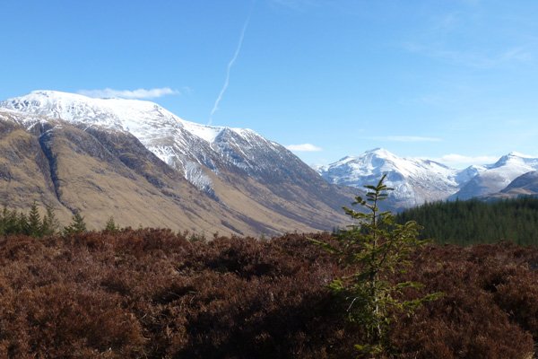
- Continue on the Glen Nevis Trail, ignoring the path on the right (Peat Track). The path starts to descend through heath/birch woodland affording good views of Meall an t-Suidhe on the flanks of Ben Nevis.
- Ignore the track on the right (marked with orange posts) and continue on the yellow-way marked trail, keeping left. The path passes through a lovely section of birch and alder woodland as you near the Brave heart Car-park (an alternative starting point for this walk). Keep right passed by the car-park.
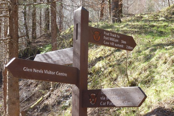
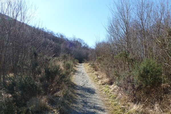
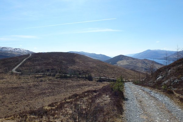
- At the signpost, turn right onto the Cow hill Summit via Peak Track, passing by a metal gateway. The forest track passes through spruce and larch plantation.
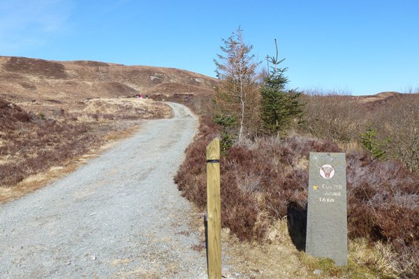
- At the next signpost, take the path on the right (yellow way-maker post), signposted Peak Track to Fort William, Cow Hill Summit. (2.8km).
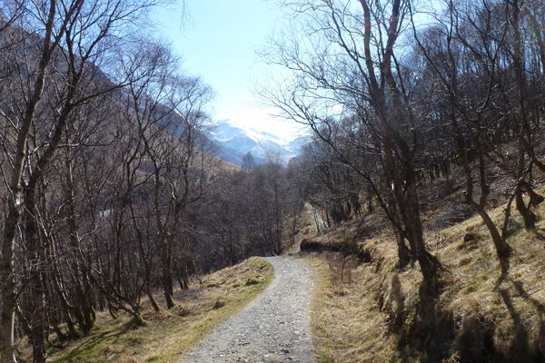
- The path ascends steeply through larch and spruce plantation, interspersed with specimens of beech, birch and rowan. Look back on occasion for fine views over to the Ben Nevis Range.
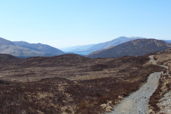
- Continue on passed the boardwalk that leads to the artist studio, Outlandia. Pass through a gate and ascend gradually on a gravel path through heathland. There are stunning views of the Nevis Range and beyond.
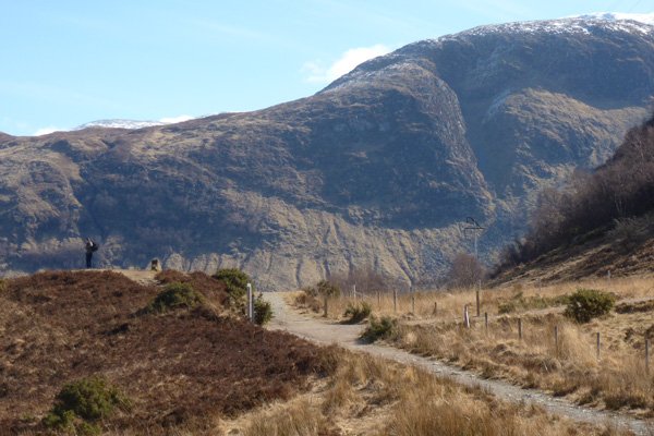
- At the T-junction, turn right and ascend gradually following the signpost to Cow hill Summit 1.6km (black way-marker post). Cross a stile at a metal gate beyond which the track descends and ascends on ocassion. There are some lovely views over Loch Linnhe.
- The path ends at a telecommunications tower (Cow Hill Digital TV Transmitter). There are two viewpoints here, one to the side of the transmitter and one to the rear. The viewpoint at the rear is marked by a cairn and affords fabulous panoramic views of Loch Linnhe, Loch Eil, Fort William and Corpach and the surroundings hills.
- Return by the same route to the junction enjoying the fabulous views on the Ben Nevis Range on your return route.
- At the junction, head straight on and continue to descend through heathland following the yellow marker posts signposted to Town Centre. There is a welcome bench on this section.
- At the signpost (with a map and yellow way-marker post), turn right heading through a wooden gate on a wide footpath. . The path descends and ascends through heath and grassy heath with gorse and birch encroachment. Cross the undulating track as directed and continue on the signposted route.
- Keep right at the junction, following yellow way marker posts to Glen Nevis, continuing on an undulating path through birch woodland/open heath. There are great views of Fort William on the left. At the next junction, turn left to retrace your steps back, and keep right to return to the car-park behind the Leisure Centre.
starting grid ref
parking grid ref
terrain
length
Safety
Route details and information are provided in good faith. All walking is potentially dangerous and it is your responsibility to ensure that you are properly dressed and equipped, have a map and compass, have checked and planned your route in advance and are able to navigate effectively. Maps displayed on these walking pages are intended as an overview of the walk and are NOT suitable for navigation. Please follow the Scottish Outdoor Access Code and respect landowners and residents' privacy. Always check the weather forecast and let others know if you are walking in the hills.


