


Glen Righ and Inchree Falls
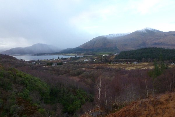
A lovely walk to an impressive series of waterfalls, with fine views of Loch Linnhe and the hills of Ardgour.
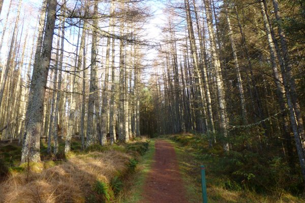
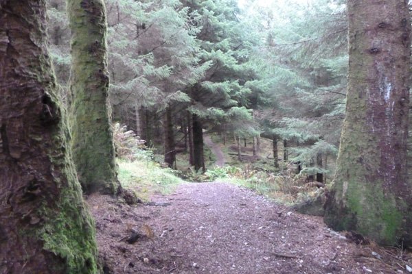
The route passes mainly through coniferous woodland and heath with a lovely section of deciduous woodland at the start of the walk. The deciduous woodland includes hazel, holly, rowan, oak and birch with understorey species of hard fern (Blechnum spicant), male and butler ferns (Dryopteris spp) and great woodrush (Luzula sylvatica), and with an abundance of mosses including Thuidium tamariscinum (Common Tamarisk-moss) and species of Spaghnum, Hypnum. Dicranium and Polytrichmum, according to local conditions. Look out for bluebells and array of other early flowering plants in Spring.
The coniferous plantations include mainly larch, spruces and pines and support an abundance of bryophytes at their edges, as well as ferns and flowering plants; the latter include wood sorrel, cranesbills, violets, devil's bit scabious and St John’s wort (Hypercium spp).
The trees are variously festooned in mosses and foliose and shrubby lichens (Usneion communities), depending on local conditions, to create an enchanting ambiance to the walk.
The heath community is mainly of Calluna- Vaccinium-Erica assemblages with purple moor grass (Molinia caerulea) and bog myrtle (Myrica gale), with some birch encroachment.
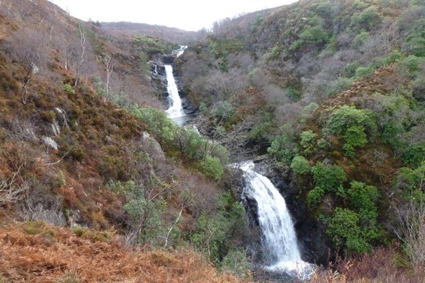
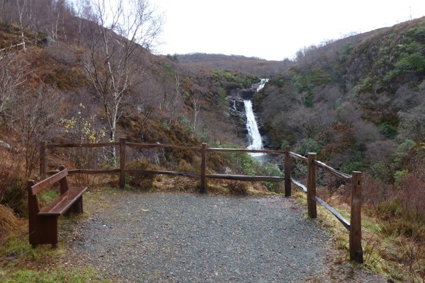
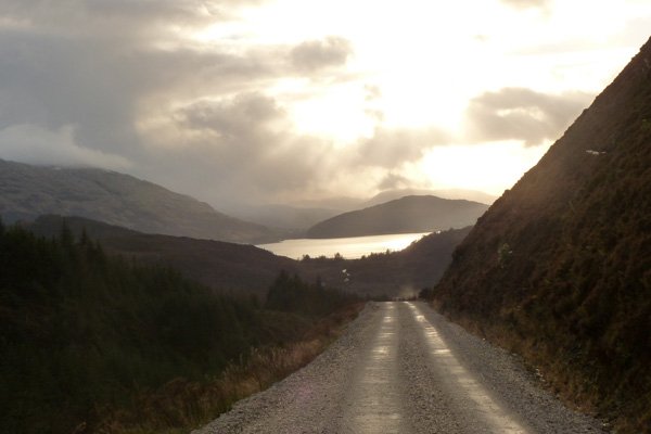
The highlight of the walk is a series of eight waterfalls cascading for over 100 metres in a deep gorge. There are also some lovely views of Loch Linnhe and the surrounding hills of Ardgour.
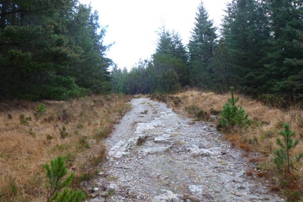
Part of the route follows Wade’s road, with its rock cut ditches. The military road was constructed after the first Jacobite uprising in the early eighteen century to allow rapid deployment and movement of troops from nearby garrisons.
The bedrock consists variously of quartzite (Appin formation) or micaceous psammite and semipelite; both rock types formed from low grade metamorphism of Precambrian sedimentary rocks (545 to 1000 million years ago). There are also superficial fluvial and glacial deposits of clay, silt, sand and gravel from the Quaternary Period.
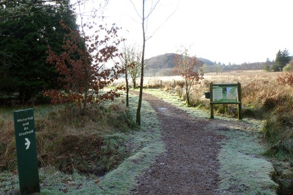
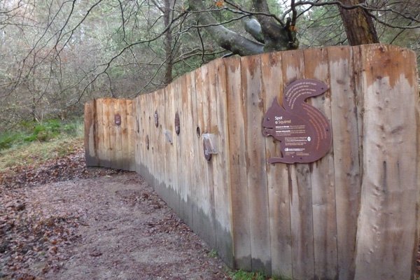
There is an interpretation board at the start of the walk and several welcome benches and picnic tables on route. This walk combines sections of the Waterfall walk (2.5 km) and Wades Road Walk (3.8km). The trail is way marked with red posts on good paths but with some steep sections of route.
Glen Righ woods are also a hot spot for red squirrels. There is a feeding station and an open viewing hide at the car park, as well as information about the behaviour and ecology of red squirrels.
Route details
- The walk starts at the sign to Waterfall and An Drochaid Walk by the interpretation board. Follow the gravel path, keeping left and skirting by a cottage.
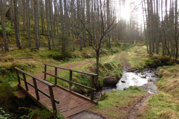
- Cross a wooden bridge over stream and begin to ascend, skirting a pine plantation, towards a viewpoint overlooking the series of waterfalls and pools.
- Continue to ascend to another viewpoint and then onwards until you reach a T-junction.
- At the T junction turn left (heading towards the car park and Wade’s road) along the forest track as it descends. The track skirts heathland on right and plantation (mainly Sitka spruce and pine). Both sides of the track are lined with broom (Cytisus scoparius). Eventually the track heads through larch plantation.
- At the crossroads, turn tight following the red-way marker posts. Alternatively take the red and white marker post to head directly back to the car-park for a much shorter walk.
- If continuing, the path ascends through larch and spruce plantation with a rich bryophytes understorey community, and epiphytic bryophytes and lichens (e.g. Parmelion communities). This is a lovely section of the walk, but with some steep sections. Cross the bridge /ford and continue to ascend through spruce and pine plantation on the well defined stone track (Wade’s road). There is a viewing bench just by the disused quarry.
- At the crossroads, turn left, skirting in front of the quarry, following the red way-marker posts, followed by another left to skirt the far side of the quarry.
- The track descends through spruce plantation to eventually emerge to provide some stunning views of Loch Linnhe and the surroundings hills of Ardgour.
- Continue to descend on the track with plantation initially on the left and Calluna heath assemblages on the steep slopes on the right. The track eventually enters plantation on both sides.
- At the picnic bench, turn left as signposted heading on a gravel path through spruce plantation back to the car park. The path emerges by the Vertical Descents Activity Centre. Continue in front of the centre and follow the red way-marker post back to the car park.
starting grid ref
Links to useful Information
terrain
length
Safety
Route details and information are provided in good faith. All walking is potentially dangerous and it is your responsibility to ensure that you are properly dressed and equipped, have a map and compass, have checked and planned your route in advance and are able to navigate effectively. Maps displayed on these walking pages are intended as an overview of the walk and are NOT suitable for navigation. Please follow the Scottish Outdoor Access Code and respect landowners and residents' privacy. Always check the weather forecast and let others know if you are walking in the hills.


