


Glen Beasdale
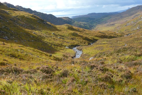
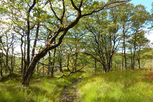

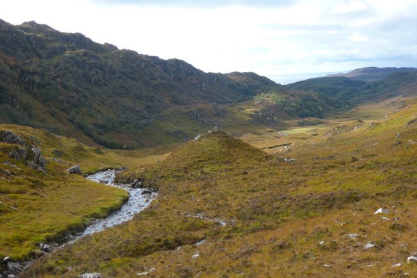
A lovely walk through oak wood and onto open heath, following the Beasdale Burn towards Bealach a Mhama. Stunning views of the surrounding hills of Aodam an t Sidhein Mhoir and Sidean Mor to the north, Drium Fiaclach and Glac Ruadh to the south and Beinn na Caorachand Beinn nan Cabar to the east. Scattered clumps of oak and birch cloak the lower slopes, or cling to the steep upper slopes, or are confined to gullies, contrasting with bare, exposed rock.
The oaks are strewn with epiphytic bryophytes and lichens, with an understory of heather (Calluna vulgaris), bilberry (Vaccinium myrtillus), hard fern (Blechnum spicant) and purple moor-grass (Molinia caerulea).
The heath is composed of ling and bell heather (Calluna vulgaris, Erica tetralix and E. cinerea), Bog Asphodel (Narthecium ossifragum), bog myrtle (Myrica gale), with devil’s bit scabious (Succisa pratensis), cotton grass (Eriophorum ssp) and a variety of sedges and rushes in the wetter areas.
Rocky outcrops and boulders are encrusted with white, green and grey lichens.
Look out for redstart, whitethroat, black cap, chiffchaff, wood warblers, coal and blue tits, woodpecker and woodcock in the oakwoods; linnet, stonechat on the open heath; and raptors including golden eagle and peregrine falcon) and ravens in the hills. Check out the burn for dippers, sandpipers, and otters.
Look out on route for the tracks, signs and possible sightings of red deer, roe deer, stoat, weasel, pine marten, badger, and wild cat.
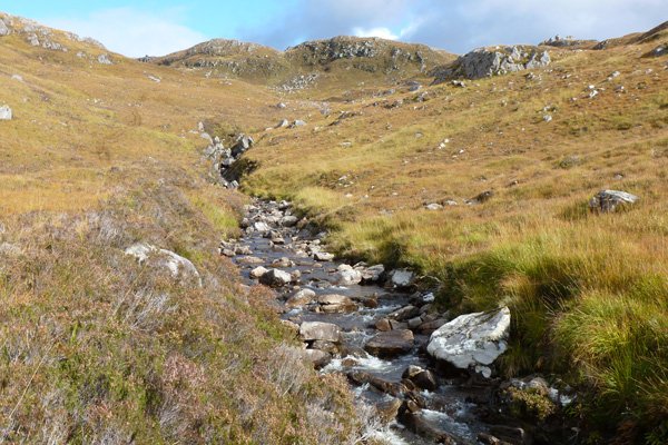
The path can be a little indistinct in places, and very boggy. There are also several stream- crossing on route using stepping stones. Waterproof foot ware is essential.
A lovely walk in Morar with fabulous views easy accessible from Moidart and the Ardnamurchan.
Route Details
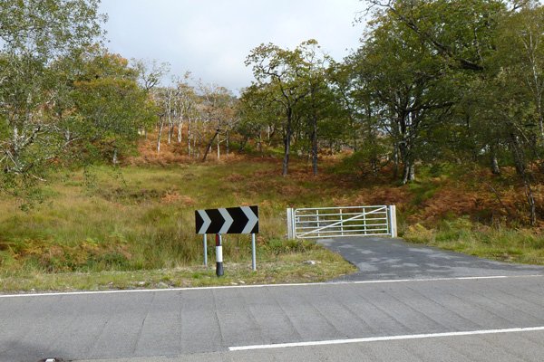
1. The walk starts from a metal gate just east of Beasdale Station. Park by the metal gate at the start of the walk or in nearby layby to the south of start point.
Pass through the metal gate and ascend through an oak wood. Following a faint path/track as it ascends gradually through the oak woodland before descending to cross a small burn.
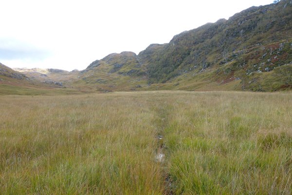
2. Take the left path immediately after crossing the burn, onto open heath. The path is very boggy bout generally well defined. The path heads towards the far end of the Glen, affording fabulous views of the surrounding hills on route.
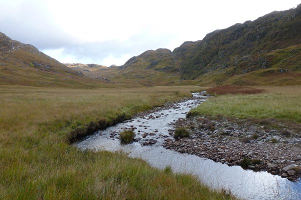
3. Keep right by a small knoll with an exposed outcrop on the left, following a narrow path. This path follows Beasdale Burn, which emerges ahead as a ‘meander loop’. On reaching the burn, cross another small stream and continue to follow the faint path, with Beasdale Burn on your right, through wet grassland (with sedges and rushes) and interspersed with bog pools.
The path skirts right of another knoll covered with heather, before crossing another stream.
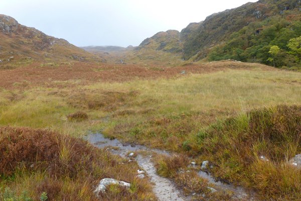
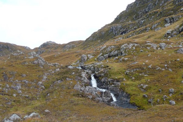
4. Pass through a gap in a drystone wall, after which the path is well defined and stony. Follow the path as it heads gently uphill, skirting Beasdale Burn and heading towards a waterfall in the distance.
5. Once passed the waterfall, cross another stream and continue on the path, taking time to enjoy the fabulous views.
Continue passed another waterfall, heading to a gully at the head of the valley, crossing a few more streams on route.
6. The walk stops where the path crossed Beasdale Burn at the top of the gully. If you wish you can continue to climb to Bealach a Mhama or turn back at this stage.
7. Return by the same route heading down the Glen and keeping close to Beasdale Burn. Alternatively, you can opt to stay on the higher ground for a longer distance by following the path that keeps right of the knoll with the rock outcrop.
Both routes eventually meet up just beyond the knoll to join the outbound route.
starting grid ref
Links to useful Information
terrain
length
Safety
Route details and information are provided in good faith. All walking is potentially dangerous and it is your responsibility to ensure that you are properly dressed and equipped, have a map and compass, have checked and planned your route in advance and are able to navigate effectively. Maps displayed on these walking pages are intended as an overview of the walk and are NOT suitable for navigation. Please follow the Scottish Outdoor Access Code and respect landowners and residents' privacy. Always check the weather forecast and let others know if you are walking in the hills.


