


Fassfern


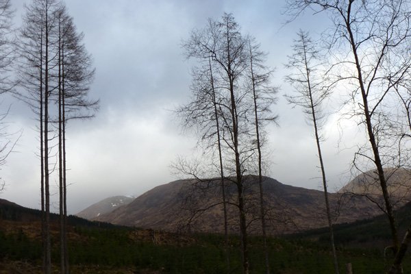


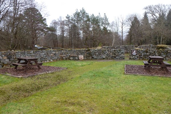
There are three walk short way marked routes through the Fassfern Estate. This walk combines sections of all three to produce an interesting and scenic walk through deciduous woodland, coniferous forest and moorland. The route is mostly along well-defined tracks with some small ascents and descents. There are some good views over Loch Eil. There are also picnic benches and a barbeque spot in the car-park area providing an ideal spot for lunch.
Legend states that Bonnie Prince Charlie visited Fassfern in 1745 and picked a white rose for his bonnet; this ‘White Cockade’ became the emblem of the aspiring king.
Look out for siskins, bullfinches, woodpeckers, cross bills, buzzards, dippers and pine martens on route. The diverse habitat also provides for a range of butterfly species, including the globally threatened chequered skipper butterfly, Carterocephalus palaemon, which is restricted to a small number of sites in western Scotland.
Route Details
1. The road to Fassfern is signposted from the A861. At the car park an interpretation board details three short waymarked tracks. This walk combines sections of the red, yellow and blue routes to produce interesting and scenic walk through Fassfern estate.
Take the red route heading across a lawned area and through a gate at the back of the car park. The path veers to the right past a small lochan with benches along its banks. The path/track ascends slightly through open ground with scattered oaks and birches. Look out for a range of butterfly species and day-flying moths in the open glades, including the abundant scotch argus (Erebia aethiops), speckled wood (Pararge aegeria) and the rare chequered skipper (Carterocephalus palaemon).
The track continues to ascend through spruce/larch plantation fringed with rushes, ferns and dense patches of the mosses, Polytrichum commune and various Spaghnum species in the wetter areas on route.
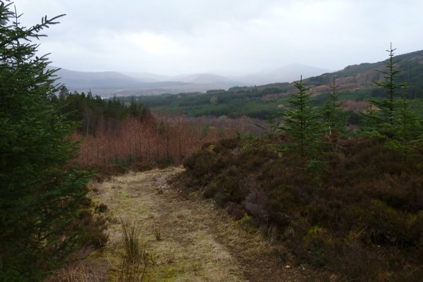
2. At a T junction, turn left onto the gravelled forest road to join the yellow route providing good views of other sections of plantation of various age structures.
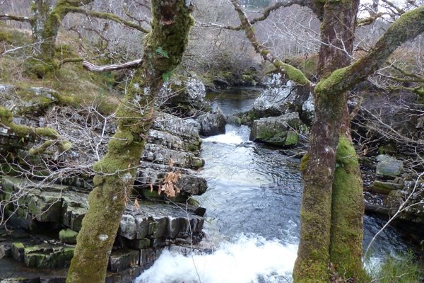
3. After about 500 metres, turn right heading down a track to Glen Suileag. Turn back on occasion to admire the views of the surrounding hills. The path soon runs parallel with the river Beul Ath nan Dearcag as evident from the sound of babbling water as it rushes over a series of small waterfalls. The tree-lined, boulder strewn river is particularly beautiful with the slightly yellow hued, fast flowing water runs over obliquely layered Moine schists.
The path eventually crosses the river at a wooden bridge; a great place to admire the river and look out for dippers.
4. Turn left after crossing the bridge to join the blue route following the river on the other bank. After about 100 metres turn right along a wide grassy path, indicated by a blue way-marker post and head up the steep hill.
5. At a T- junction, turn left at the waymarker post and continue along a gravelled track. Ignore the first track on the left but take the second track as directed by the blue waymarker post. At the bottom of the track, turn left and cross a stream. The route continues by the edge of another section of plantation following the river for most of the route back towards the bridge. This is a particularly lovely section of the walk, with the banks of the river fringed with some fine oaks, abundantly strewn with mosses and lichens. There are also some birch and holly.
6. Continue onwards at the wooden bridge following the yellow waymarker posts and continue to follow the river. There a number of benches on route providing a wonderful opportunity to reflect on the beauty of the boulder strewn, crystal clear, fast following river and its fauna and flora.
7. The track eventually diverges away from the river into birch oak woodland. Some of the trees are amazingly old oaks, well endowed with epiphytic mosses, lichens and ferns. There are also some fine hazel stands and mature Scots pines. The path eventually returns to the car park.
starting grid ref
terrain
length
OS Map
Safety
Route details and information are provided in good faith. All walking is potentially dangerous and it is your responsibility to ensure that you are properly dressed and equipped, have a map and compass, have checked and planned your route in advance and are able to navigate effectively. Maps displayed on these walking pages are intended as an overview of the walk and are NOT suitable for navigation. Please follow the Scottish Outdoor Access Code and respect landowners and residents' privacy. Always check the weather forecast and let others know if you are walking in the hills.


