


North Side Trail - Rum

A lovely walk (The North Side Trail) along the north side of Kinloch Glen with some stunning mountain views and traversing a mosaic of habitats including woodland, heath, wet meadow and bog.
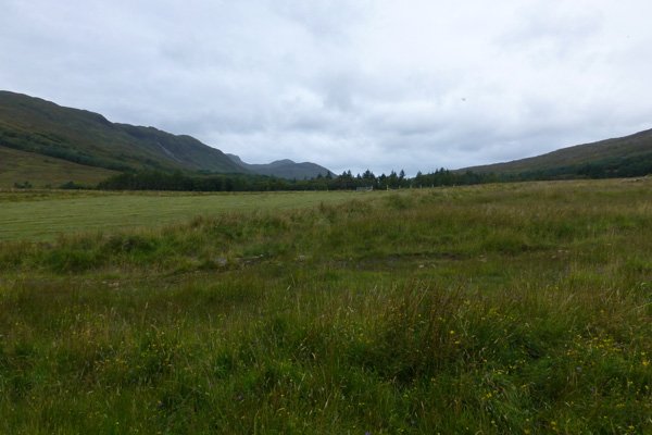
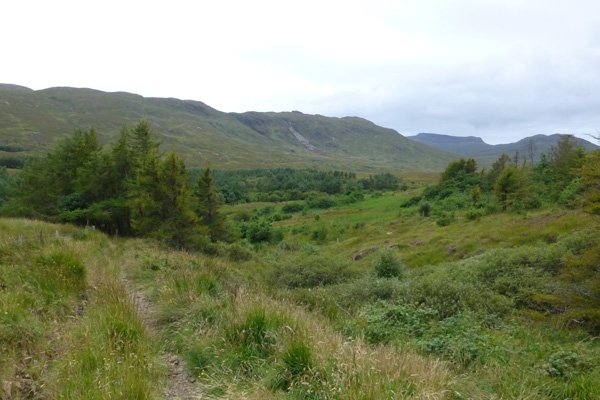
The walk skirts around fields with some lovely wooded sections. The fields (mainly wet meadow/pasture) are a riot of colour (yellow, whites, pinks and purples) in Spring and Summer, for example with bird-foot trefoils (Lotus corniculatus and L. pendunculatus), ragged robin (Lychnis flos-cuculi), red clover (Trifolium pratense), devil’s bit scabious (Succusa pratensis), meadow sweet (Filipendula ulmaria), common valerian (Valeriana officinalis), sneezewort (Achillea ptarmica), purple loosestrife (Lythrum salicaria), yellow flag iris (Iris pseudacorus) and marsh ragwort (Senecio aquaticus) according to season. Look out also for marsh, spotted and fragrant orchids.
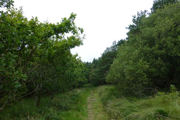
The wooded sections consist of oak, birch, rowan, sycamore, alder, willow, hazel, holly, hawthorn and bird cherry. There are some lovely copses of Scots pine, and a small plantation of larch.
There are also some lovely sections of heath on route, with heather and bell heathers (Erica cinerea and E. tetralix), purple moor grass, devil’s bit scabious, tormentil, and bog asphodel; hued with pinks and purples in mid to late summer.
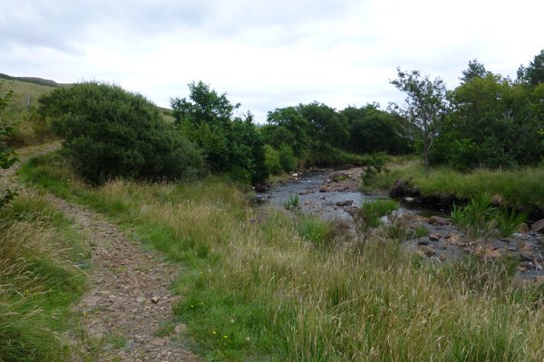
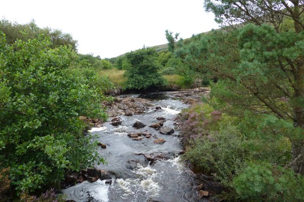
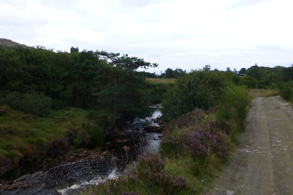
The walk also skirts Kinloch Burn, with its lovely mini waterfalls and large deposits of pebbles and boulders, and a wooded fringe of hazel, willow and alder. The walk also passes by some traditional crofts.
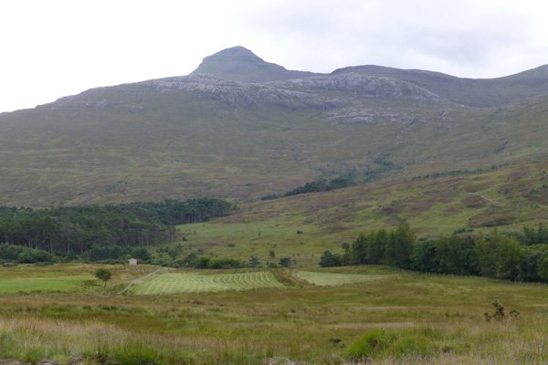
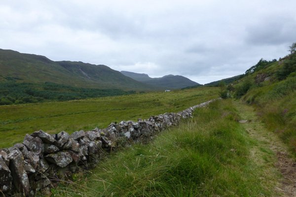
The bedrock geology around Kinloch is mainly sandstone (gravelly) formed between 545 to 1000 million years ago with some igneous intrusions (Palaeogene Dyke Suite). The walk also affords the opportunity to admire the volcanic peak of Hallival, a caldera (a collapsed magma chamber formed around 60 million years ago) that occupies the southern half of Rum. This is contrasted with the Torridonian sandstone of Mullach Mor on the hills above the path.
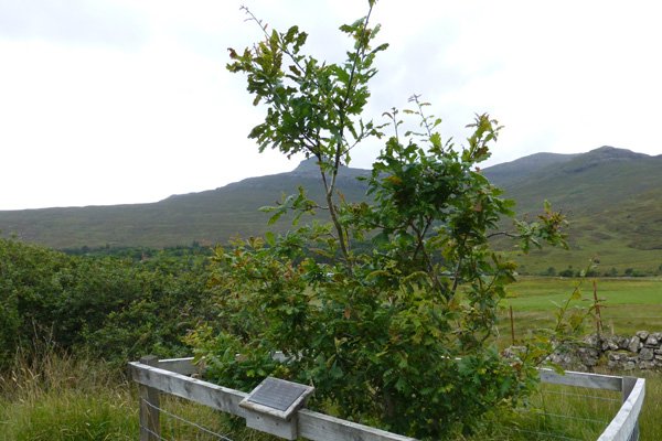
The walk passes by the Millionth Tree which was planted in April 1997 by Rum’s first Warden (Peter Wormell) to celebrate the 40th anniversary of the National Nature Reserve and the commitment to restoring the island’s native woodland.
Look out for warblers in the wooded sections, as well as pipits, wheatear, stonechat, merlin and hen harrier on open ground. Look out for raptors and corvids along the ridges, including golden eagle and raven. Look out for dippers and otters on the burn, and white-tailed eagle both inland and on the coast.
Rum also supports one of the largest breeding colonies of Manx shearwaters who make their nests in burrows in the steep upper slopes of Hallival, Askival, Trollval and Barkeval.
Butterflies that may be seen on route include peacock, red admiral, small tortoiseshell, small heath, large heath, meadow brown, small pearl bordered fritillary, dark green fritillary, green hairstreak, grayling and speckled wood, according to season.
Look out for the free roaming ponies, reputed to be the oldest Highland Pony stud in the world. The ponies were used to carry deer carcasses from the hills during the deer stalking season.
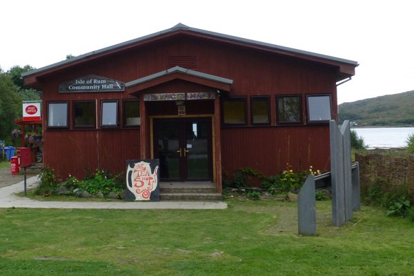
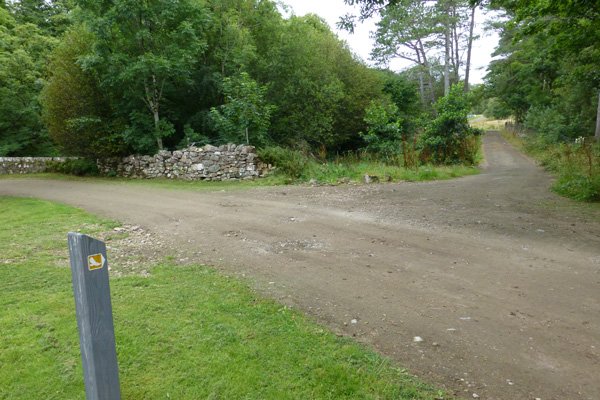
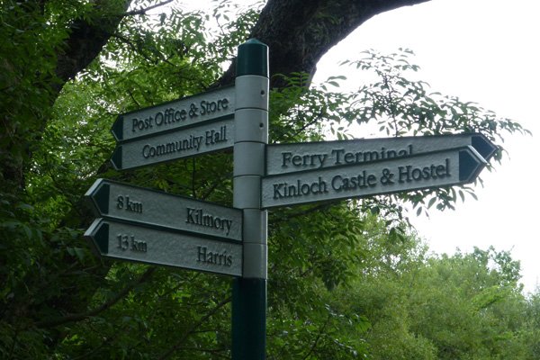
The walk is clearly signposted on a well defined path (grassy, loose gravel, stone) but with some muddy sections. There is also a trail guide available for the Rum Visitor Centre. There is also some additional information and a sightings board at the Community Hall.
Route Details
- Start at the walk at the Village/Community Hall at the far end of Kinloch. Head away from the Hall and turn right just before the bridge over Kinloch Burn as indicated by a marker poster with a yellow eagle icon.
- Follow the burn for a short distance, then turn right through a gate as directed on to grassy track between two fields; open meadow on the left and with small copse of the right. Once passed the copse, there is open meadow on both sides with a beech hedge on the left for a short distance.
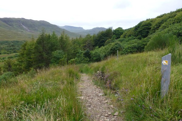
- Pass through a wooden gate and through another gate onto heath and then through a small copse. There are some lovely ridge views along this stage of the walk with peaks of Hallival and Barkeval clearly evident.
- Pass by The Millionth Tree, a celebration of forty years of Rum’s National Nature Reserve status. At this stage the path is skirted periodically by a deciduous woodland fringe and further along by a stone wall. Cross over a small stream.
- Turn left as directed on an undulating path with some steep sections. Take care as the path can be slippery underfoot. The path passes by the edge of a field and then close to Kinloch Burn, after which it skirts the burn for a distance.
- Keep left just passed Croft 3 heading away from the burn on a small path that skirts around the bottom of a field with hill views to the right.
- Cross over Kinloch burn on a wooden bridge and turn left as directed onto a stone/gravel track.
- Turn left where the track meets a T-junction. Pass through a metal gateway and head back to the Community Hall.
starting grid ref
Links to useful Information
terrain
length
Safety
Route details and information are provided in good faith. All walking is potentially dangerous and it is your responsibility to ensure that you are properly dressed and equipped, have a map and compass, have checked and planned your route in advance and are able to navigate effectively. Maps displayed on these walking pages are intended as an overview of the walk and are NOT suitable for navigation. Please follow the Scottish Outdoor Access Code and respect landowners and residents' privacy. Always check the weather forecast and let others know if you are walking in the hills.


