

Geopark Rock Route 17 - Sallachan Bay


Details
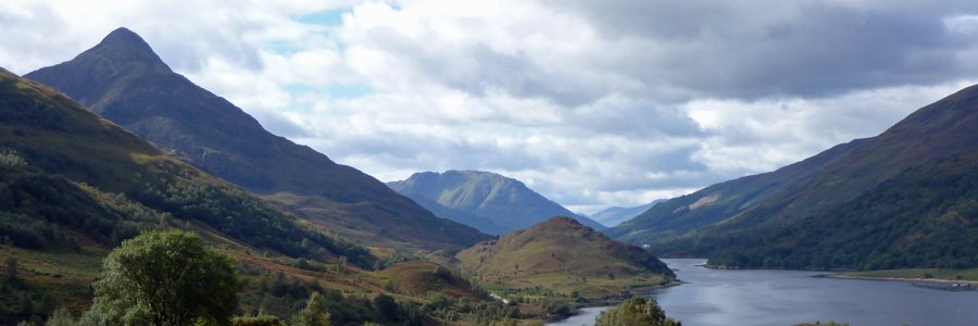
The interpretation board is sited to provide good views of the volcanic caldera of Ben Nevis and Glen Coe. These two volcanoes were formed 420 million years ago. The board describes the formation of the two caldera and the importance of these two features to the landscape.
The board also overlooks two fjords (long narrow inlets formed in valleys by glacial action). Loch Linnhe approximately 50km and the smaller Loch Leven. The board describes how both these fjords were formed by glacial action. Loch Linnhe marks out the Great Glen Fault, an a fault plane of crushed rock, which separates Dalradian Supergroup (composed of schists, quartzites, limestones and slates) from the older Moine Supergroup (composed mainly mica schists). The Great Glen Fault marks the collision between a small tectonic plate (Avalonia) and the Laurentian plate.
A great board to help you interpret the local landscape; a landscape formed by the action of plate collisions, volcanic eruptions and glaciation events.
The board sited in a layby 4km south of Ardgour.


