


Geopark Rock Route 11 - Glen Loy
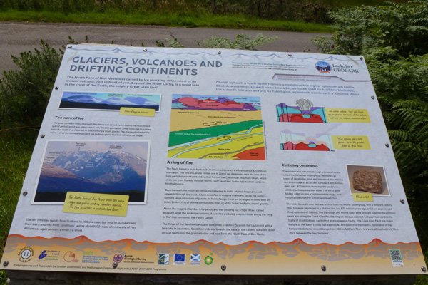
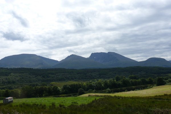
The interpretation board overlooks the north face of Ben Nevis and describes in detail the effects of glaciers, volcanoes and continental drift on the Nevis Range.
The board describes how the Nevis Range formed millions of years ago by the processes of mountain building and volcanic activity. Ben Nevis represents the remains of an ancient volcano with a collapsed caldera, intruded into even older rocks. The various sections of bedrock are shown diagrammatically, and range from sedimentary rocks (Ballachulish limestone), metamorphic rocks (ancient Dalradian schists and quartzite), intrusive igneous rocks (inner granite, outer granite and dolerite) and extrusive igneous rocks (andesite lavas). The Dalradian schists and quartzite are separated from Moine schists by the crushed rocks associated with the Great Glen Fault.
The Great Glen Fault separates the Northwest Highlands (Northern Highlands) from the southeast Grampian Highlands The Great Glen Fault, over 100km long, marks the collision between the Laurentia and Baltic tectonic plates at the end of the Silurian (approximately 430 million years ago), with the sinistral strike-slip (left lateral) movement, later to be followed by a dextral movement (right lateral). Minor faults run parallel to the Great Glen Fault.
The board also describes how the corrie (a hollow) beneath the summit of Ben Nevis was formed by the action of a small glacier in the last Ice Age, which ended less than 11, 500 years ago.
The board clearly shows the complex rock formations of the Nevis Range, formed by collisions and volcanoes, and later sculpted by ice. This board provides a fascinating insight into Scotland’s turbulent geological past, which resulted in the formation of the highest mountain in the British Isles at 1,344 metres.
The board is located in the layby off the B8004, just southwest of Glen Loy.
A very interesting and informative board with excellent interpretation of the local topography.


