
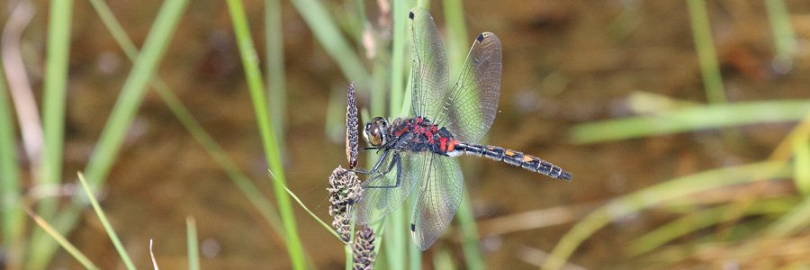

The Lochaber Geopark board describes the Great Eucrite ring complex centred around Achnaha. The ring complex consists of ring of Eucrite hills and marks the position of a subterranean magma chamber and its feeder pipe. Three ring complexes were described on the Ardnamurchan peninsula by J.E....
Lochaber Geopark Rock Route
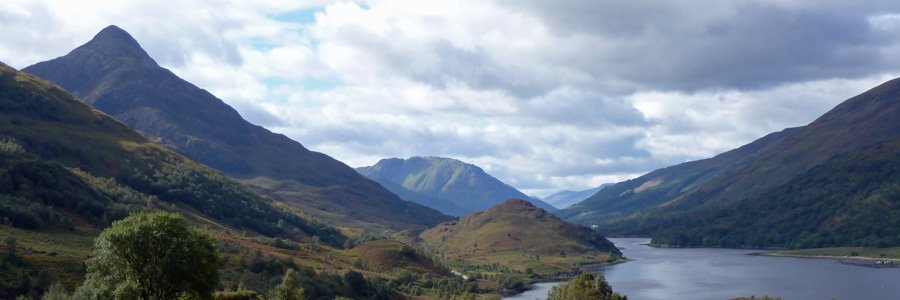
The Highlands has a rich, long and complex geological history dominated by the collision of tectonic plates, and involving uplift and mountain building, volcanic eruptions, glaciations events, and long periods of erosion and deposition, as well as extensive metamorphism of pre-existing rocks. This has resulted in three distinct terranes; Grampian Terrane, Northern Highland Terrane and the Hebridean Terrane, each characterised by different geological histories and rock types.
Lochaber’s geological history is recorded in rocks that spans over 570 million year ago, with the some of the oldest rocks in Lochaber being associated with the Moine Thrust. It encompasses two of the terranes, the Northern Highland Terrane and the Grampian Terrane, and contains four ancient volcanoes, delivering an exceptionally varied geodiversity and an outstanding geomorphology.
The Geopark Rock Routes have been produced by The Lochaber Geopark Association, an organisation concerned with promoting the geology and geomorphology of Lochaber.
The Lochaber Geopark Association has grouped the interpretation boards into five themed routes, which include volcanoes (western and eastern), mountain building, glaciations and strata and fossils. There are also six regional routes (Geotrails) that include various combinations of the interpretation boards. These include Ardnamurchan, Glen Coe, Glen Nevis, Glen Roy, Loch Leven, Morvern, Road to the Isles, Strontian and The Small Isles. Details of each of these Geotrails can be found at Lochaber Geopark website and as leaflets in Tourist Information and Visitor Centres.
A great set of resources to immerse yourself in the outstanding geology and scenery of Lochaber.
(Ardnamurchan)
(Spean Bridge)

An excellent interpretation board on the formation of the Ben Nevis Range and the Grey Corries. The boards explains how these mountain ranges were formed by the collision of two plates, melting and the subsequent sculpturing of the landforms by ice. The interpretation board identifies the...
![]()
(Ardgour)

The interpretation board is located in the car park of the village hall in Trislaig. The interpretation board is sited to provide fine views of the Ben Nevis Range (Aonach Mor, Car Mòr Dearg and Ben Nevis), as well as Cow Hill and Fort William. The board describes the formation of the Ben...
![]()
(Glen Nevis)

This excellent interpretation board describes the origins of the Ben Nevis, the remains of a volcano that erupted over 400 million years ago during the collision of two continental plates. The board describes how Ben Nevis is composed of both igneous and Dalradian metamorphic rocks, including...
![]()
(Spean Bridge)

This geological board describes the origin and importance of the Great Glen.
The Highlands are divided by the Great Glen into the Northern Highlands and the Grampian Highlands. The Northern Highland terrane is composed of Moine Supergroup, rocks that were originally laid down as...
![]()
(Morvern)

An excellent interpretation board exploring the effect of volcanoes and shifting continental plates on the geology and topography of Morvern. Repeated lava flows have shaped the landscape of Morvern resulting in ‘trap topography’, very much evident around Loch Aline. The interpretation board...
![]()
(Ardgour)

A fascinating board describing the impact of the Great Glen Fault on the geology and topography of Lochaber. The Great Glen Fault, aligned north-east to southwest, separates rocks of the Moine Supergroup on the west (Northern Highland terrane) from rocks of the Dalradian Supergroup in the east...
![]()
(Ardnamurchan)

This board focuses on the Ardnamurchan volcano and the surrounding geology. Ardnamurchan is renowned for its ‘ring complex’ and consists of three overlapping volcanic ‘centres’. Each of the centres has sequentially served as a magma feeder pipe in the distant past. A diagram shows the...
![]()
(Ardnamurchan)

An interesting interpretation board providing an oversight of the geology of the region with reference to origins of Ben Hiant, a mountain which rises to a height of 528m and dominates the Ardnamurchan peninsula. This interpretation describes the geology of Ben Hiant, and the important role...
![]()

A fascinating insight into the geology and topography around Loch Aline. The rock types include volcanic lavas, Jurassic shales and limestones, and white silica-rich sandstones. The sandstones were formed in shallow seas and represents a pure form of silica dioxide (SiO2) (silica)....
![]()
(Fort William)

The interpretation board overlooks the north face of Ben Nevis and describes in detail the effects of glaciers, volcanoes and continental drift on the Nevis Range.
The board describes how the Nevis Range formed millions of years ago by the processes of mountain building and volcanic...
![]()
(Ballachulish)

The board describes the origin and properties of slate and its uses in construction.
Ballachulish slate is part of the Dalradain Supergroup, laid down as fine grained mudstone in anoxic conditions. The board describes how these shales were metamorphosed (involving recystallisation) into...
![]()
(Morar and Arisaig)

The interpretation board focuses on the four ancient volcanoes that have been responsible for shaping the Inner Hebrides. These volcanoes were active 60 million years ago.
The board is sited to allow you to observe three of these much eroded volcanoes (Ardnamurchan, Rum and Skye). The...
![]()
(Morar and Arisaig)

This interpretation board describes how volcanic activity has been responsible for formation of some of the most iconic features on Skye such as the Black Cuillin Mountains and Red Hills of Skye.
Similarly the distinctive topography of Askival on Rum and the plateau on Eigg have volcanic...
![]()
(Nether Lochaber)

An interesting board describing the enormous contribution of James Hutton to the field of geology. In the 18th Century Hutton argued, contrary to popular belief, that the Earth has been subject to a continual state of change (involving cycles of mountain building, volcanic activity,...
![]()
(Ardnamurchan)

The board describes the origin of the Great Glen, gouged out by ice along a fault line formed by an oblique collision of two continents (Laurentia and Avalonia) over 430 million year ago.
The board describes how the fault is composed of crushed rock and extends in excess of 40 metres...
![]()
(Ardgour)

The interpretation board is sited to provide good views of the volcanic caldera of Ben Nevis and Glen Coe. These two volcanoes were formed 420 million years ago. The board describes the formation of the two caldera and the importance of these two features to the landscape.
The board...
![]()
(Spean Bridge)

This interpretation board describes the geology and topography of Glen Coe area, based around an ancient volcanic caldera. The board describes how the caldera was formed over 420 million years ago involving circular faults and subsidence. The geology of Glencoe caldera is shown as a...
![]()
(Spean Bridge)

These two boards are sited in a small car park to provide a good overview of the Parallel Roads in Glen Roy, a world famous geological feature. The Parallel Roads refer to a series of parallel lines etched into the hillsides of the glen at 260 metres, 325 meters and 350 metres above sea level. ...
![]()
(The Small Isles)


