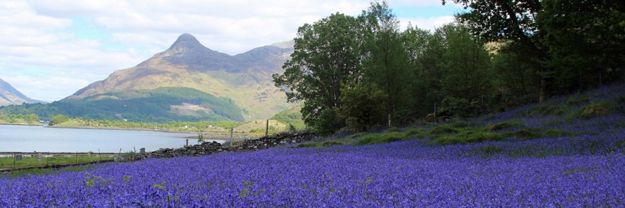
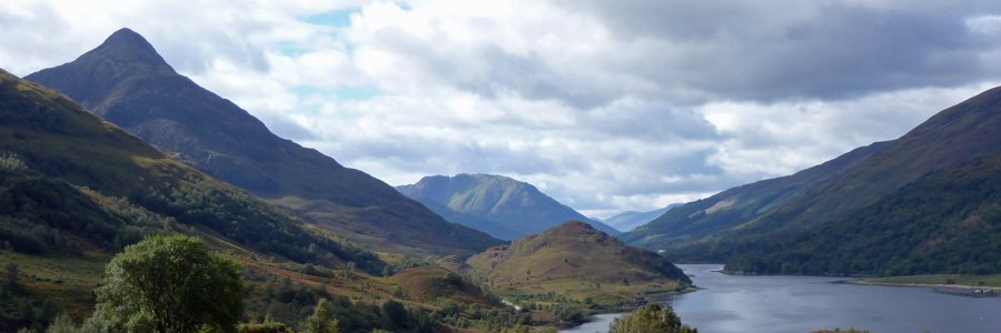

This is a lovely woodland walk in Ardgour, near Fort William, through ancient semi-natural woodland and then out onto heath. There are some lovely coastal views over Loch Linnhe towards Fort William, Corpach, Inverlochy and the Ben Nevis Range on route, as well as at...
Walks in Fort William, Glen Nevis and Spean Bridge
Fort William is the centre of The Outdoor Capital of The UK. It is a great base for walking up Ben Nevis and along Glen Nevis as well as a start point for The West Highland Way. There are a great range of walks from hill walks to gentle strolls along river banks, all with a wildlife focus. See individual walking pages for OS maps and route descriptions.
terrain: woodland path and road
grade: easy
length: 2.2km (1.4 miles)
grid ref: NN095750
type: circular
terrain: canalside path
grade: easy
length: 4.7km (2.9 miles)
grid ref: NN097767
type: circular

The walk starts at the lower loch at Corpach (Corpach Sea Loch), at the foot of the Caledonian Canal and heads along the towpath to Neptune’s Staircase. The route returns on the towpath on the opposite side of the canal
The Caledonian Canal is a 62 mile long waterway between Corpach in...
![]()
terrain: path and road
grade: easy
length: 4.5km (2.75 miles)
grid ref: NN105743
type: circular

A pleasant walk between the Old Fort in Fort William and Old Inverlochy Castle along the banks of the River Lochy. The return route is through the village of Inverlochy, with its tribute to Aluminium Industry, the main employer of the region. The walk includes a section along Wade’s Road (...
![]()
terrain: track and path
grade: moderate
length: 8.9 km (5.6 miles)
grid ref: NN111742
type: circular

This is a fabulous walk, affording some stunning views of the Ben Nevis Range , Loch Linnhe and Loch Eil and the township of Fort William and its environs.
The walk passes through some lovely sections of deciduous woodland, forestry plantation and heathland. The deciduous woodland...
![]()
terrain: grassy path
grade: easy
length: 1.6 km (1 mile)
grid ref: NN120911
type: circular

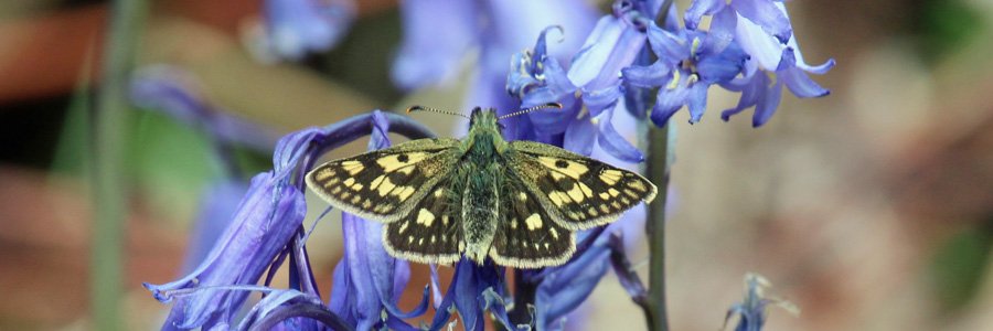
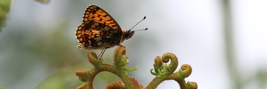
Alt Mhuic Butterfly Reserve is on the north shores of Loch Arkaig in Lochaber. The reserve is managed jointly for the conservation of butterflies by the Forestry Commission and Butterfly Conservation.
This pleasant scenic short walk passes through grassland, heath and open deciduous...
![]()
terrain: track and path
grade: moderate
length: 10.5km (6.5 miles)
grid ref: NM122736
type: there and back

Dun Deardail is a vitrified iron age Highland hill fort on a prominent knoll on the north facing spur of Sghorr Chalum in Glen Nevis. It is thought to have been built at sometime between first millenium BC and the first millenium AD. The fort occupies 1250 square metres and dominates the south...
![]()
terrain: Steep path and scree
grade: challenging
length: 17km (10.5 miles)
grid ref: NN123731
type: there and back

The most popular route up Ben Nevis starting from the Glen Nevis Visitor Centre.
![]()
terrain: forest track
grade: easy
length: 3km (1.9 miles)
grid ref: NN144811
type: there and back

The track ascends through coniferous plantation (mainly firs and spruces) with some sections of mixed woodland consisting of willow, hazel, birch, cherry, beech, sycamore, whitebeam and rowan. The grassy verges support creeping and field buttercup (Ranunculus acris and R. repens...
![]()
terrain: towpath and road
grade: easy
length: 6.6 km (4.1 miles)
grid ref: NN144811
type: circular

The walk includes a lovely section along the Caledonian Canal passing between two aqueducts (Shengain Aqueduct and Glen Loy Aqueduct), and incorporates part of the Great Glen Way. The road section provides good views of Caledonian Canal and the River Lochy, as well as some lovely hill views,...
![]()
terrain: track and path
grade: easy
length: 4.3 km (2.7 miles)
grid ref: NN149821
type: there and back

A walk through spruce plantation to a lovely remnant of oak woodland.
Most of the walk is on a forest tracks through a plantation of mainly Sitka spruce with scattered rowan, bird cherry, willow and hazel. The verges support bluebell, creeping and meadow buttercups, tormentil, greater...
![]()
terrain: track and path
grade: easy
length: 3.4km (2.1 miles)
grid ref: NN170773
type: circular

A lovely short walk along the banks of the River Lundy and through the plantation woodland of Leanachan Forest with some botanical interest.
The route passes through sections of spruce plantation. The plantation is skirted on route by fringes of mixed woodland of alder, goat willow and...
![]()
terrain: uneven path
grade: moderate
length: 5.2km (3.2 miles)
grid ref: NN168691
type: there and back

A lovely walk through the steep-sided Nevis Gorge to an impressive waterfall, An Steall, cascading from a hanging valley (Coire A’ Mhail). This is a very impressive short walk with much geological and botanical interest, as well as stunning mountain views of the slopes of Ben Nevis, and some of...
![]()
terrain: road, track and path
grade: easy
length: 9.2km (5.75 miles)
grid ref: NN177888
type: there and back

A lovely walk along the southern shores of Loch Arkaig to the mountain bothy on the banks of the River Mallie. The walk takes in Chia-aig waterfalls with a deep plunge pool which has been liken to a Witch's cauldron. The Chia-aig falls featured in the Hollywood film, Rob Roy. The walk affords...
![]()
terrain: canal path and road
grade: easy
length: 6.2km (3.9 miles)
grid ref: NN175842
type: circular

A pleasant short circular walk along the towpath of the Caledonian Canal to Moy Bridge, returning along a minor road (B8004). The route along the canal follows the Great Gen Way.
The Caledonian Canal is a 62 mile long waterway between...
![]()
terrain: good path and road
grade: easy
length: 4.7 km (3 miles)
grid ref: NN208824
type: circular

An interesting walk in heathland and woodland through Glen Spean, with good views of the Nevis Range. The route includes a section of Wade’s military road with its historic High Bridge (built in 1736 over the River Spean), as well as part of the disused railway line between Invergarry and Fort...
![]()
terrain: woodland path
grade: easy
length: 4.4km (2.7 miles)
grid ref: NN227815
type: circular

A lovely walk through a deciduous and plantation woodland with some fine of Glen Spean, Aonach Mor and the Grey Corries.
The walk heads through some lovely sections of mixed deciduous woodland, variously composed of birch, willow (Salix aurita) and rowan, with some particular fine...
![]()
terrain: road and track
grade: easy
length: 6.75 km (4.25 miles)
grid ref: NN253799
type: there and back

A lovely walk to the wooden statue of the Wee Minister, a cedar wooden replica by Peter Bowsher of a former stone statue that stood on a nearby site.
The route initially follows the River Spean for a short distance on a minor road which is fringed with birch, hazel, oak, hazel, alder, ash...
![]()
terrain: woodland path and road
grade: moderate
length: 4.5km (2.8 miles)
grid ref: NN270813
type: lollipop

A very pleasant walk through a lovely section of mixed woodland along the banks of the River Spean in Glen Spean. The walk affords some fine views of the Spean Gorge, an impressive channel cut by turbulent glacial waters.
Most of the route is through mixed deciduous riperian woodland...
![]()
terrain: track and path
grade: easy
length: 2 km & 5.4 km (1.2 & 3.4 miles)
grid ref: NH283014
type: circular

There are two lovely short walks in the Forestry Commission Glen Garry Native Pinewoods (Ciste Dubh Trail and Alt na Cailliche). Both routes pass through deciduous and pine woodland in The Glen Garry Forest Area, following the River Garry for part of the way, and affording some lovely views....
![]()
terrain: good path
grade: moderate
length: 12km (7.5 miles)
grid ref: NN483873
type: there and back

A stunning walk with fabulous hill views to lochan a Choire in Coire Ardair, following the watercourse, Allt Coire Ardair, in the Creag Meagaidh National Nature Reserve.
The route has some steep sections but for much of the way rises fairly gently to the lochan along a very good gravel...
![]()
terrain: good path
grade: easy
length: 1 & 2km (.6 & 1.2 miles)
grid ref: NN483873
type: circular

Three lovely short walks from the car park in Creag Meagaidh National Nature Reserve providing an opportunity to experience various habitats, including meadow, ancient alder woodland and heath land. The walks offer some stunning of views of Creag Meagaidh massif and Loch Laggan.
...
![]()


