
Bunkhouse accommodation in woodland setting
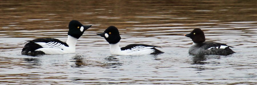
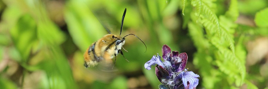
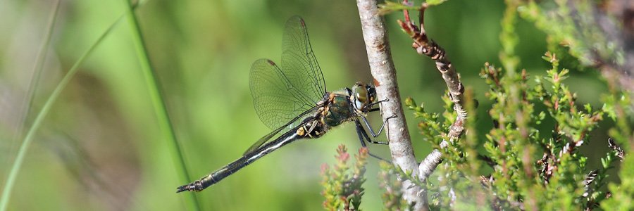
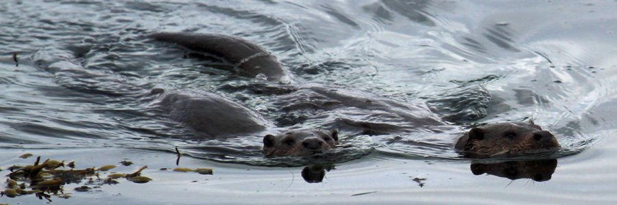
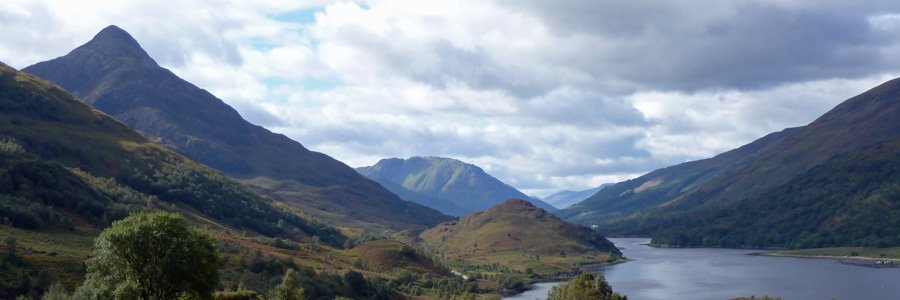
Walks in Moidart, Ardnamurchan and The Rough Bounds including Arisaig, Mallaig and Morvern
Walks in Moidart, Ardnamurchan and surrounding areas.
The map shows the start point of each walk. The approximate route is shown on each individual walking page.
| 1 |
Allt Mhuic Butterfly Reserve (Loch Arkaig) Alt Mhuic Butterfly Reserve is on the north shores of Loch Arkaig in Lochaber. The reserve is managed jointly for the conservation of butterflies by the Forestry Commission and Butterfly Conservation. |
terrain: grassy path grade: easy length: 1.6 km (1 mile) grid ref: NN120911 type: circular |
| 2 |
Alphabet Trail (Sunart) Two pleasant short walks with scenic views of Ben Resipole and Loch Sunart in The Ardnamurchan, Lochaber |
terrain: track and path grade: easy length: 1.5-3km (1-2 miles) grid ref: NM693644 type: lollipop |
| 3 |
An Torr and Signal Rock (Glencoe) A lovely short walk through coniferous plantation to Signal Rock; reputed to be a gathering place for the MacDonalds of Glencoe at times of trouble and the place where, according to legend, the signal was given by the Campbells for the Glencoe Massacre. |
terrain: woodland path grade: moderate length: 3km (1.9 miles) grid ref: NN128564 type: circular |
| 4 |
Aoineadh Mor (Morvern) An interesting circular walk to explore the deserted township of Aoineadh Mor |
terrain: forest and grassy paths grade: moderate length: 3.4km (2.1 miles) grid ref: NM668517 type: circular |
| 5 |
Ardmolich Woodland Walk (Moidart) A magical woodland walk through coniferous plantations to the hills beside Loch Moidart. Spectacular views. |
terrain: forest and moorland track grade: moderate length: 3.3km (2 miles) grid ref: NM716714 type: lollipop |
| 6 |
Ardnastaing and Scotstown (Sunart) A circular walk over moorland, woodland and along the banks of the Strontian River to Scotstown and Ardnastaing. |
terrain: path, track and road grade: easy length: 7.7km (4.8 miles) grid ref: NM805621 type: circular |
| 7 |
Ardnish and Peanmeanach (Morar and Arisaig) A popular walk to the beach and bothy at Peanmeanach on the Ardnish Peninsula. Great views over Loch nan Uamh and the surrounding hills. |
terrain: hill path, boggy in places grade: challenging length: 11km (6.75 miles) grid ref: NM742835 type: there and back |
| 8 |
Ardtornish Castle (Morvern) An easy walk along road and track to the ruins of Ardtornish Castle on The Morvern Peninsula. Fabulous views over the Sound of Mull. |
terrain: road and track grade: easy length: 13.4km (8.4 miles) grid ref: NM702474 type: there and back |
| 9 |
Ariundle Oakwoods (Sunart) An interesting but fairly strenuous walk through Ariundle Oakwoods to the former lead mines at Bellsgrove via Ceann a ’Chreagain. |
terrain: Forest and moorland track grade: moderate length: 10-11 km (6.5 miles) grid ref: NM826634 type: lollipop |
| 10 |
Bay MacNeil Beach (Ardnamurchan) A short walk to a beautiful beach with fabulous views of The Small Isles and Ardnamurchan Point. |
terrain: grassy path and beach grade: easy length: 2.6km (1.6 miles) or less grid ref: NM429671 type: there and back |
| 11 |
Bay of Flies (Sunart) A short circular walk through native oak woodland to a sheltered bay on Loch Sunart |
terrain: woodland path grade: easy length: 0.7km (0.5 miles) grid ref: NM702644 type: circular |
| 12 |
Ben Hiant (Ardnamurchan) A pleasant walk up Ben Hiant on mostly well defined path with amazing views over Ardnamurchan, Morvern, Mull, The Small Isles and beyond. |
terrain: grassy path grade: moderate length: 4.4km (2.75 miles grid ref: NM551641 type: there and back |
| 13 |
Ben Resipole (Sunart) Ben Resipole, a Corbett, is the highest peak on the Ardnamurchan, and affords spectacular views of Loch Shiel, Loch Sunart, the Small Isles and Skye. |
terrain: mountain track grade: challenging length: 16km |
| 14 |
Blain Burn Circular (Moidart) A lovely walk through woodland and then out onto open heath, skirting around the edge of Blain lochan with good views of the surrounding hills of Beinn Gheur and Beinn Bhreac and stunning views over Loch Moidart to the Small Isles. |
terrain: track and path grade: moderate length: 6.4 km (4 miles) grid ref: NM677694 type: circular |
| 15 |
Bourblach Beach at Morar (Morar and Arisaig) A short walk to the fantastic silver sands on Bourblach beach in Morar Bay. The beach is the real star of this walk. |
terrain: grassland path and beach grade: easy length: 2.2km (1.4 miles) grid ref: NM675935 type: there and back |
| 16 |
Bourblaige Cleared Settlement (Ardnamurchan) An interesting walk to the small halmet/clachan of Bourbliage located on the southern shore of the Ardnamurchan peninusula on the south-east flank of Ben Hiant, between Camus nan geall and Macleans' Nose. |
terrain: path and field grade: moderate length: 2.6km (1.6 miles) grid ref: NM555629 type: there and back |
| 17 |
Brecklet Trail (Ballachulish) A lovely walk, mainly through plantation, on a well defined path, with some stunning views of the surrounding hills and of Loch Leven and Loch Linnhe. The route starts at the former Ballachulish Slate Quarry and returns through the lovely village of Ballachulish. |
terrain: path and road grade: easy length: 2.9km (1.8 miles) grid ref: NN084584 type: circular |
| 18 |
Caledonian Canal Aqueducts (Fort William) The walk includes a lovely section along the Caledonian Canal passing between two aqueducts (Shengain Aqueduct and Glen Loy Aqueduct), and incorporates part of the Great Glen Way. |
terrain: towpath and road grade: easy length: 6.6 km (4.1 miles) grid ref: NN144811 type: circular |
| 19 |
Camas nan Geall (Ardnamurchan) A coastal walk along shingle beaches along the southern coast of the Ardnamurchan Peninsula with good chances of spotting otters and eagles. |
terrain: path, track and shingle beach grade: moderate length: 5.4km (3.4 miles) grid ref: NM563616 type: there and back |
| 20 |
Camusdarach Beach and Beyond (Morar and Arisaig) A walk to Camusdarach is more than a visit to a stunning beach. Take time to explore the coast, dunes and wildlife amongst stunning scenery. |
terrain: path, beach and optional road grade: easy length: 3.8km (2.4 miles) grid ref: NM664917 type: circular |
| 21 |
Castle Tioram Circular (Moidart) A very pleasant and interesting walk through woodland, heathland, moorland and along coastal tracks with stunning views over Loch Moidart and Castle Tioram. |
terrain: rough track - vertiginous in places grade: moderate length: 6.1 km (3.8 miles) grid ref: NM664714 type: circular |
| 22 |
Castle Tioram Viewpoint (Moidart) This amazing viewpoint overlooking Castle Tioram and Loch Moidart is just a short diversion from the Blain Burn or Castle Tioram Circular walks |
terrain: open hillside grade: moderate length: 2.6km (1.6 miles) grid ref: NM675713 type: there and back |
| 23 |
Claish Plantation (Sunart) A lovely walk through mainly coniferous woodland on a forest track with some fine glimpses of Ben Repisole on route, and of Loch Shiel towards the end of the track at the edge of Claish Moss. Good opportunities for dragonfly stalking. Optional detour to Claish Moss. |
terrain: Forest track grade: easy length: 12 km (7.5 miles) grid ref: NM690659 type: there and back |
| 24 |
Coire Ardair (Loch Laggan) A stunning walk with fabulous hill views to lochan a Choire in Coire Ardair, following the watercourse, Allt Coire Ardair, in the Creag Meagaidh National Nature Reserve |
terrain: good path grade: moderate length: 12km (7.5 miles) grid ref: NN483873 type: there and back |
| 25 |
Corrantee Lead Mines from Ardnastaing (Sunart) A lovely walk along the old coffin route between Ardnastaing to Polloch to The Corrantee Lead Mines. Great views and a real sense of wilderness. |
terrain: track and path (boggy in places) grade: moderate length: 11.4km (7.1 miles) grid ref: NM805621 type: there and back |
| 26 |
Corrantee Lead Mines from Polloch (Sunart) A lovely walk through plantation and heath to the remains of the Corrantee Lead mine and beyond with fine views of Ardamurchan, Sunart and Morvern. A great walk for views and wildlife and a sense of wilderness. |
terrain: track and path grade: easy length: 7.6km (4.7 miles) grid ref: NM795680 type: there and back |
| 27 |
Cow Hill (Fort William) This is a fabulous walk through deciduous woodland, forestry plantation and heathland to Cow Hill, affording some stunning views of the Ben Nevis Range , Loch Linnhe and Loch Eil and the township of Fort William and its environs. |
terrain: track and path grade: moderate length: 8.9 km (5.6 miles) grid ref: NN111742 type: circular |
| 28 |
Creag Meagaidh Short Walks (Loch Laggan) Three lovely short walks from the car park in Creag Meagaidh National Nature Reserve providing an opportunity to experience various habitats, including meadow, ancient alder woodland and heath land. The walks offer some stunning of views of Creag Meagaidh massif and Loch Laggan. |
terrain: good path grade: easy length: 1 & 2km (.6 & 1.2 miles) grid ref: NN483873 type: circular |
| 29 |
Crofters Woods (Fort William) This is a lovely woodland walk in Ardgour, near Fort William, through ancient semi-natural woodland and then out onto heath. |
terrain: woodland path and road grade: easy length: 2.2km (1.4 miles) grid ref: NN095750 type: circular |
| 30 |
Cuil Bay to Rubha Mor (Duror) A lovely walk around the shingle beaches of Cuil Bay on the Ardsheal peninsula. Good views are afforded of Loch Linnhe and the islands of Balnagowan, Shuna and Lismore, as well as some fine views of Ardsheal hill and beyond. |
terrain: path and track grade: easy length: 3.6km (2.2 miles) grid ref: NM979553 type: there and back |
| 31 |
Dalilea Walks (Moidart) A starting point for two very pleasant walks; one along the banks of Loch Shiel to the Green Isles, and the other over the hills to Kinlochmoidart |
terrain: track grade: moderate length: 4.4km & 8.3km (1.4 & 5.1 miles) there and back grid ref: NM734691 type: there and back |
| 32 |
Dorlin Low Road (Moidart) An easy and enjoyable walk from Castle Tioram at Dorlin along the banks of the River Shiel with good opportunties for spotting wildlife. |
terrain: track grade: easy length: 4.6km (2.9 miles) grid ref: NM664720 type: there and back |
| 33 |
Dun Deardail (Fort William) The walk to the vitrified iron age fort at Dun Deardail is a is a lovely scenic walk along forest tracks, with fine views of Ben Nevis, the Nevis Range and Glen Nevis |
terrain: track and path grade: moderate length: 10.5km (6.5 miles) grid ref: NM122736 type: there and back |
| 34 |
Erracht Oakwood Walk (Fort William) A walk along forest track to Glen Loy native oakwoods |
terrain: track and path grade: easy length: 4.3 km (2.7 miles) grid ref: NN149821 type: there and back |
| 35 |
Fairy Walk (Sunart) A country road, hill, woodland and river side circular walk with good views of Ben Resipole, Loch Sunart and the Strontian River. |
terrain: path, track and road grade: easy length: 6.9km (4.3 miles) grid ref: NM815616 type: circular |
| 36 |
Fascadale and Port Eigin-aig (Ardnamurchan) A lovely walk from Fascadale Bay on the Ardnamurchan peninsula to the shingle inlet of Port Eigin-aig on the Ardnamurchan peninsula. |
terrain: boggy path grade: moderate length: 7km (4.4 miles) grid ref: NM502707 type: there and back |
| 37 |
Fassfern (Glenfinnan) Three short waymarked tracks through decidoudus woodland, coniferous forest and moorland. A good site for for butterflies including the globally threatened chequered skipper butterfly. |
terrain: waymarked track grade: moderate length: 2.4 - 7km (1.5 - 4.4 miles) grid ref: NN696728 type: circular |
| 38 |
Fort William and Old Inverlochy Castle (Fort William) A pleasant walk between the Old Fort in Fort William and Old Inverlochy Castle along the banks of the River Lochy. The return route is through the village of Inverlochy, with its tribute to Aluminium Industry, the main employer of the region. |
terrain: path and road grade: easy length: 4.5km (2.75 miles) grid ref: NN105743 type: circular |
| 39 |
Gairlochy Caledonian Canal (Spean Bridge) A pleasant short circular walk along the towpath of the Caledonian Canal to Moy Bridge, returning along a minor road (B8004). |
terrain: canal path and road grade: easy length: 6.2km (3.9 miles) grid ref: NN175842 type: circular |
| 40 |
Galmadale Dam (Morvern) This is pleasant short walk along a track to Glen Galmadale Dam and Fish Ladder with some stunning views of the ridges of the Galmadale Horseshoe. The walk can be extended to visit a waterfall in dry condition, along the path is boggy and ill-defined. |
terrain: track grade: easy length: 3.2 km (2 miles) grid ref: NM867531 type: there and back |
| 41 |
Garbh Eilean Wildlife Walk (Sunart) An occasionally steep, but well surfaced gravel path meandering through native woodland from Ardery to the Garbh Eilean Wildlife Hide |
terrain: track - steep in places grade: easy length: 1.5km (1 mile) grid ref: NM746619 type: there and back |
| 42 |
Ghardail Loop (Morvern) An enjoyable circular walk through forest plantation across The Ghardail River and onto the hills around Kingairloch |
terrain: track and path grade: moderate length: 4km or 5.75 km (2.5 or 3.6miles) grid ref: NM837535 type: circular |
| 43 |
Glasdrum Oakwoods (North Argyll) A lovely walk through Glasdrum National Nature Reserve, a woodland reserve renowned for it’s exceptional bryophyte and lichen flora, as well as one of the top sites for chequered skipper and pearl border fritillary butterflies. The walk affords some stunning views of Glen Creran and the fjordic sea loch, Loch Creran. |
terrain: woodand path - steep in places grade: easy length: 1km (0.6 miles) grid ref: NN001454 type: circular |
| 44 |
Glen Beasdale (Morar and Arisaig) A lovely walk through oak wood and onto open heath in Glen Beasdale, following the Beasdale Burn towards Bealach a Mhama, with stunning views of the surrounding hills. |
terrain: track and boggy path grade: moderate length: 5.2km (3.25 miles) grid ref: NM716852 type: there and back |
| 45 |
Glen Creran Pine Marten Trail (North Argyll) A lovely short walk through plantation and mixed deciduous woodland in Glen Creran with some fine views, historical connections and good wildlife spotting opportunities. |
terrain: grassy path and track grade: easy length: 2.2 km (1.4 miles) grid ref: NN036488 type: circular |
| 46 |
Glen Moidart (Moidart) An enjoyable walk with good views of the dendritic tributaries of Glen Moidart and the hill lochan, Loth nan Lochan, before ascending to the reservoir at Glen Forslan. |
terrain: track grade: moderate length: 5.2km (3.2 miles) grid ref: NM740722 type: there and back |
| 47 |
Glen Righ and Inchree Falls (Onich) A circular walk up a gorge passing eight mighty falls and onwards along a section of historic Wade's road returning with magnificant views of Loch Linnhe |
terrain: good path and forest track grade: easy length: 5km (3.1 miles) grid ref: NN030634 type: circular |
| 48 |
Glenborrodale Nature Trail (Ardnamurchan) A pleasant walk through deciduous woodland onto heath/moorland above on the north shore of Loch Sunart. |
terrain: path with steep ascent/descent grade: moderate length: 2.6km (1.6 miles) grid ref: NM601608 type: circular |
| 49 |
Glencoe Lochans (Glencoe) An interesting walk around a lochan and through planted coniferous and native deciduous woodland. There are lovely views of Bidean Nam Bian and The Pap of Glencoe, which dominate the landscape. |
terrain: path grade: easy length: 1.3 - 5 km (1 - 3 miles) grid ref: NN105594 type: circular |
| 50 |
Glencoe Woodland Walk (Glencoe) A lovely circular woodland walk through mixed deciduous woodland and plantation with some fine mountain views. |
terrain: track and raod grade: easy length: 3.1km (1.9 miles) grid ref: NN112575 type: circular |
| 51 |
Glendrian and Port Eigin-aig (Ardnamurchan) A walk through the Ardnamurchan Caldera to the deserted village of Glendrian and onto the beach at Port Eigin-aig. |
terrain: track and boggy path grade: challenging length: 9km (5.6 miles) grid ref: NM470678 type: there and back |
| 52 |
Glenfinnan Viaduct and Station (Glenfinnan) An interesting walk affording some great views of the Glenfinnan monument, Loch Shiel and the surrounding hills and crags. The walk passes through a range of habitat types, including woodland, heath and bog. |
terrain: boggy hill path, track and road grade: moderate length: 3.3km (2 miles) grid ref: NM906808 type: circular |
| 53 |
Glenfinnan Viewpoints (Glenfinnan) Three walks from The National Trust at Glenfinnan to viewpoints of the monument, viaduct and Loch Shiel. The Dragonfly boardwalk provides easy access to Caledonian pinewoods and the River Callop. |
terrain: path and track grade: easy length: 4 & 0.5 km (2.5 & 0.3 miles) grid ref: NM907807 type: there and back |
| 54 |
Glengarry Native Pinewoods (Glengarry) Two lovely short walks in the Glen Garry Native Pinewoods (Ciste Dubh Trail and Alt na Cailliche). Both routes pass through deciduous and pine woodland in The Glen Garry Forest Area, following the River Garry for part of the way, and affording some lovely views. |
terrain: track and path grade: easy length: 2 km & 5.4 km (1.2 & 3.4 miles) grid ref: NH283014 type: circular |
| 55 |
Glenloy Forest and Strone Viewpoint (Fort William) A short walk along forest tracks in Glen Loy forest to a viewpoint with good views of the north face of Ben Nevis and Anoach Mor |
terrain: forest track grade: easy length: 3km (1.9 miles) grid ref: NN144811 type: there and back |
| 56 |
Greadal Fhinn Chambered Cairn (Ardnamurchan) A short walk to admire the remains of the chambered cairn, Greadal Fhinn, on the summit of a knoll at Ormsaigmore on the Ardnamurchan peninsula. |
terrain: track and field grade: easy length: 1.2km (0.75 miles) grid ref: NM479636 type: there and back |
| 57 |
High Bridge and The Commando Memorial (Spean Bridge) A lovely historic walk from The Commando Memorial along the banks of the River Spean passing by the historic High Bridge with fine views of the Nevis Range. |
terrain: good path and road grade: easy length: 4.7 km (3 miles) grid ref: NN208824 type: circular |
| 58 |
Jubilee Bridge (North Argyll) A lovely short walk over the historic 19th century jubilee bridge crossing salt marsh and affording fine views of Castle Stalker, Appin. |
terrain: path and road grade: easy length: 3 km (1.9 miles) grid ref: NM924465 type: circular |
| 59 |
Kentra Bay and The Singing Sands (Ardnamurchan) An enjoyable walk to the beautiful Singing Sands at Gortenfern in The Ardnamurchan. |
terrain: mainly forest track grade: moderate length: 9.8km (6.2miles) grid ref: NM650677 type: there and back |
| 60 |
Kentra Moss Circular (Ardnamurchan) A circular walk on track and road across Kentra Moss with good opportunities for botanising and bird watching. |
terrain: track and road grade: moderate length: 6.9km (4.3 miles) with optional shortcuts grid ref: NM674680 type: circular |
| 61 |
Killiechonate Woodland Walk (Spean Bridge) A lovely walk through a deciduous and plantation woodland with some fine of Glen Spean, Aonach Mor and the Grey Corries. |
terrain: woodland path grade: easy length: 4.4km (2.7 miles) grid ref: NN227815 type: circular |
| 62 |
Kilmory Beach (Ardnamurchan) A short walk to Kilmory Beach, a lovely sheltered sandy beach on the north coast of the Ardnamurchan peninsula. |
terrain: grassy path and track grade: easy length: 1.6km (1 mile) grid ref: NM529701 type: there and back |
| 63 |
Kinlochaline Low Road (Morvern) This is a lovely walk along a tarmac track by the shores of Loch Aline through coastal deciduous woodland, affording some lovely views of the loch, surrounding hills and Ardtornish House. |
terrain: track grade: easy length: 7.4km (4.6 miles) grid ref: NM680446 type: there and back |
| 64 |
Kinlochmoidart Old Road (Moidart) An interesting walk along the old track on the north side of Loch Moidart that formerly connected Glenuig and Kinlochmoidart. |
terrain: path, vertginous in places grade: moderate length: 3.6km (2.2 miles) grid ref: NM694728 type: circular |
| 65 |
Larachmhor Garden Walk (Morar and Arisaig) A sensory short walk through the former kitchen gardens and nursery of Glen House on the Arisaig Estate |
terrain: woodland track and path grade: easy length: 1.5km (1 mile) grid ref: NM669865 type: there and back |
| 66 |
Loch a Bhada Dharaich (Morar and Arisaig) A lovely short walk from the banks of Loch Morar to a nearby low lying hill loch. The Scots pine are a real star of this walk. |
terrain: track and boogy path grade: easy length: 3.2km (2miles) grid ref: NM698932 type: there and back |
| 67 |
Loch an Nostarie and Mallaig (Morar and Arisaig) A scenic circular walk passing through hills, heathland and the quaint fishing port of Mallaig. There is a nice picnic spot by Loch an Nostarie. |
terrain: boggy path, track and road grade: moderate length: 5.8km (3.6 miles) grid ref: NM675956 type: circular |
| 68 |
Loch Arkaig to Invermallie Bothy (Loch Arkaig) A stunning walk along the shores of Loch Arkaig leading to a delightful bothy by a river at Invermallie. |
terrain: road, track and path grade: easy length: 9.2km (5.75 miles) grid ref: NN177888 type: there and back |
| 69 |
Loch Mama (Road to The Isles)
A lovely scenic walk through Glen Màma ascending through Atlantic oak woodland and onto wet meadow and heath to access a small remote freshwater loch, Loch Màma. The walk offers the opportunity to explore the fauna and flora of a mosaic of habitats and enjoy some stunning scenery as you ascend to Loch Màma. |
terrain: path and ttrack grade: moderate length: 5.8km (3.6 miles) grid ref: NM729841 type: lollipop |
| 70 |
Loch Morar (Morar and Arisaig) A pleasant, scenic walk along the north shore of Loch Morar to Tarbet. Other local walk include Glasnacardoch to Loch an Nostarie and the Loch an Nostarie circular walk. |
terrain: mixed grade: moderate length: 2-17km grid ref: NM7257927 type: there and back |
| 71 |
Loch Teacuis Northside (Morvern) An easy walk along a private road on the North side of Loch Teacuis with an optional foray further along the side of the loch. |
terrain: Road and path grade: easy length: 8km (5 miles) grid ref: NM656541 type: there and back |
| 72 |
Mallaig Circular (Mallaig) A short circular walk around the hills and village of the small picturesque fishing port of Mallaig with great views to the Skye and The Small Isles. |
terrain: path and raod grade: easy length: 2.8km (1.75miles) grid ref: NM679968 type: circular |
| 73 |
Mingary Castle (Ardnamurchan) A short walk to Mingary Castle on The Ardnamurchan Peninsula and to a lovely rocky shoreline and shingle beach. Please note as of 2013 access to Mingary Castle is not possible due to restoration work. |
terrain: grassy path grade: easy length: 1.4km (0.9 miles) grid ref: NM500636 type: there and back |
| 74 |
Neptune's Staircase and Corpach (Fort William) Neptune's Staircase and Corpach. A very pleasant canal side walk with stunning views of the Nevis Range and the hills of Ardgour. A lovely walk for the canal and wildlife enthusiast alike. |
terrain: canalside path grade: easy length: 4.7km (2.9 miles) grid ref: NN097767 type: circular |
| 75 |
Nevis Gorge and An Steall (Fort William) A lovely walk through the steep-sided Nevis Gorge to an impressive waterfall, An Steall, cascading from a hanging valley (Coire A’ Mhail). This is a very impressive short walk with much geological and botanical interest, as well as stunning mountain views of the slopes of Ben Nevis, and some of the mountains of The Mamores. One of the finest walk in the Lochaber. |
terrain: uneven path grade: moderate length: 5.2km (3.2 miles) grid ref: NN168691 type: there and back |
| 76 |
North Side Trail - Rum (Isle of Rum) A lovely walk along the north side of Kinloch Glen on the Isle of Rum with some stunning mountain views and a mosaic of habitats including woodland, heath, wet meadow and bog. |
terrain: path and track grade: easy length: 2.8km (1.7 miles) grid ref: NM402997 type: circular |
| 77 |
Ockle to The Singing Sands (Ardnamurchan) A stunning walk from Ockle to the Singing Sands at Gortenfern on the Ardnamurchan peninsula. Lovely isolated beach and great views of the Small Isles, Mull and Skye. |
terrain: track and path grade: moderate length: 15.8 km (9.9 miles) grid ref: NM555704 type: there and back |
| 78 |
Polloch and Loch Shiel (Sunart) A walk along forest track from Polloch to the shores of Loch Shiel. Fine views fr Loch Shiel and The Polloch River. Chances of spotting golden eagle and a range of diving and dabbling ducks. |
terrain: Forest track and path grade: easy length: 4.75km (3 miles) grid ref: NM792688 type: lollipop |
| 79 |
Port Appin and Clach Thoull (North Argyll), Port Appin") A lovely short coastal walk along a promontory at Port Appin. Good views are afforded of Loch Linnhe, the Lynn of Lorne, the Isle of Lismore and the distant hills of Morvern and Mull. |
terrain: track, path & road grade: easy length: 2.2 km (1.4 miles) grid ref: NM903453 type: circular |
| 80 |
Portuairk and Bay MacNeil (Ardnamurchan) A circular walk starting in the village of Portuairk, up through the hills and along to beautiful beach at Bay MacNeil and back along single track road and woodland. |
terrain: moorland path, track and road grade: easy length: 5.5km (3.4 miles) grid ref: NM437682 type: circular |
| 81 |
Portuairk to Sanna (Ardnamurchan) A pleasant walk over gentle terrain from Portuairk to beautiful Sanna Bay on the Ardnamurchan peninsula |
terrain: gentle hills and beach grade: moderate length: 6.6km (4 miles) grid ref: NM439681 type: lollipop |
| 82 |
Prince Charlie's Cave and Borrodale Beach (Morar and Arisaig) A lovely short walk to Prince Charlie's Cave and Borrodale Beach with some fine coastal and mountain views on route. |
terrain: Track and boggy path grade: easy length: 4km (2.5 miles) grid ref: NM686844 type: there and back |
| 83 |
Prince's Walk (Moidart) An interesting circular walk through the grounds of Kinlochmoidart estate. |
terrain: path, track and road grade: moderate length: 3km (1.9 miles) and 2.6km (1.6miles) grid ref: NM710727 type: circular |
| 84 |
Rahoy Hills - Black Water (Morvern) An easy walk along a good track into the hills and wilderness behind the Scottish Wildlife Trust Rahoy Hills Reserve along the banks of the Black Water River. |
terrain: track grade: easy length: 8km (5 miles) grid ref: NM703504 type: there and back |
| 85 |
Rahoy Hills - Loch Arienas (Morvern) A walk through oak woodland and heathland along the shores of Loch Arienas to the deserted village of Arienas in the Scottish Wildlife Trust Rahoy Hills Reserve. The Rahoy Hill Reserve is designated as a Site of Special Scientific Interest and a Special Area of Conservation. |
terrain: rough path - boggy in places grade: moderate length: 4.5km (2.8 miles) grid ref: NM703504 type: there and back |
| 86 |
Rhu Point Beach (Morar and Arisaig) A rewarding walk to the magnificant beach at Port nam Murrach at the end of the Rhu peninsula near Arisaig, Morar. |
terrain: track, path and beach grade: easy length: 4.4km (2.75 miles) grid ref: NM627851 type: there and back |
| 87 |
Roy Bridge and The River Spean (Spean Bridge) A very pleasant walk through a lovely section of mixed woodland along the banks of the River Roy in Glen Spean. The walk affords some fine views of the Spean Gorge, an impressive channel cut by turbulent glacial waters. |
terrain: woodland path and road grade: moderate length: 4.5km (2.8 miles) grid ref: NN270813 type: lollipop |
| 88 |
Salen Oakwoods (Sunart) An interesting way-marked circular walk through Atlantic oakwoodlands, with a picnic bench and interpretation boards. |
terrain: woodland track grade: easy length: 1.7 km (1.1 miles) grid ref: NM691645 type: circular |
| 89 |
Shian Wood SWT Reserve Walk (North Argyll) Shian Wood is a Scottish Wildlife Trust Nature Reserve on the southern shores of Loch Creran. There is a lovely short walk through a variety of habitats including rush pasture, wet heath and oak-hazel woodland. |
terrain: woodland path grade: easy length: 2 km (1.25 miles) grid ref: NM902417 type: circular |
| 90 |
Shielfoot Torr (Ardnamurchan) A stunning walk to the vitrified iron-aged fort at Shielfoot Torr. A secret journey through ancient oak woodlands to the knife edge ridge with stunning views over The River Shiel and beyond. |
terrain: woodland path grade: moderate length: 1 km (0.8 miles) grid ref: NM665670 type: there and back |
| 91 |
Silver Walk (Moidart) An interesting and scenic coastal walk in Moidart with the possibility of seeing otters and a range of coastal birds. |
terrain: mixed grade: moderate length: 12.6km (7.9 miles) grid ref: NM716714 type: there and back |
| 92 |
Smirisary Walk (Moidart) A pleasant walk along a rough/coastal path to the ancient crofting village of Smirisary in Moidart and onto the silvery sands. |
terrain: rough track, boggy grade: moderate length: 6.5km (4 miles) grid ref: NM654773 type: there and back |
| 93 |
Sonachan Wood and Heathland (Ardnamurchan) A little gem of a walk through hazel woodland to open heathland offering a real taste of wild Ardnamurchan |
terrain: woodland and moorland path - boggy grade: moderate length: 2.4km (1.5 miles) grid ref: NM450666 type: circular |
| 94 |
St Columba's Chapel, Drimnin (Morvern) A lovely walk to the small remote chapel of St Columba on the Morvern peninsula. The impressive cream rendered chapel with its attractive stonework and distinctive battlemented tower is perched on raised ground overlooking the Sound of Mull. |
terrain: path and track grade: easy length: 3.2km (2 miles) grid ref: NM557540 type: there and back |
| 95 |
Strath of Arisaig & Camas Ghaoideil (Morar and Arisaig) A gentle walk along farm track and road through woodland and along coast providing great opportunities for bird watching with an optional detour to a secluded beach. |
terrain: track and road grade: easy length: 3.8 or 8 km (2.4 or 5 miles) grid ref: NM661863 type: circular |
| 96 |
Strontian Community Woodland (Sunart) A magical walk through a 19th Centuary policy woodland with some 60 species of native and non-native trees. A treat for the dendrologist. |
terrain: woodland path grade: easy length: 1.5km (1 mile) grid ref: NM817616 type: circular |
| 97 |
Tennyson's Waterfall (Morvern) An interesting walk to a an impressive waterfall, named in honour of Alfred, Lord Tennyson who was a regular visitor to Old Ardtornish House |
terrain: track and undefined path grade: moderate length: 5.8km (3.6 miles) grid ref: NM705473 type: there and back |
| 98 |
The River Lundy Trail (Fort William) A lovely short walk along the banks of the River Lundy and through the plantation woodland of Leanachan Forest with some botanical interest. |
terrain: track and path grade: easy length: 3.4km (2.1 miles) grid ref: NN170773 type: circular |
| 99 |
The Wee Minister (Spean Bridge) A lovely walk to the wooden statue of the Wee Minister, a cedar wooden replica by Peter Bowsher of a former stone statue that stood on a nearby site. |
terrain: road and track grade: easy length: 6.75 km (4.25 miles) grid ref: NN253799 type: there and back |


